
The Essential Aerial Photography Guide for 2025 Beginners
- Extreme Aerial Productions
- Nov 18, 2025
- 11 min read
Aerial photography is soaring in popularity across Arizona and Nevada, fueled by leaps in drone technology and a surge in demand for unique visuals. In 2025, more project managers, surveyors, and creatives are turning to aerial photography to capture perspectives once reserved for pilots.
This guide is designed for beginners ready to explore the skies and master the essentials. Whether you are photographing a Las Vegas construction site or the sweeping landscapes around Phoenix, we break down the process step by step.
You will find clear advice on choosing the right gear, understanding local laws, planning safe flights, capturing sharp images, editing like a pro, and connecting with community resources. Our team at Extreme Aerial Productions draws on real-world experience and current stats to make your first flights successful.
Ready to elevate your skills? Let’s demystify aerial photography and help you achieve professional results in the Southwest.
Understanding Aerial Photography: What Every Beginner Needs to Know
Aerial photography lets us capture the world from above, revealing patterns and perspectives you can’t see from the ground. Over the years, this field has evolved from images taken by planes and helicopters to high-resolution shots captured by drones. Today, drones make aerial photography accessible to more people than ever, whether you’re documenting a construction site or creating art. For a look at what’s possible, browse our Cool Drone Photography Gallery for real-world inspiration from Arizona and Nevada.
What is Aerial Photography?
Aerial photography is the practice of taking images from an elevated position, often using drones, planes, or helicopters. Modern drone technology has changed the landscape, making it easier for beginners to achieve professional results. Unlike traditional methods, today’s drones offer stability, GPS, and real-time feedback on your shots. You’ll find aerial photography used in real estate listings, construction progress reports, mapping, and special events. The creative potential is vast, especially in dramatic environments across Arizona and Nevada.
Key Benefits and Challenges in 2025
The main draw of aerial photography is its ability to deliver unique, sweeping views that ground-based cameras can’t match. It’s now more accessible, allowing hobbyists and professionals alike to capture images once reserved for big budgets. In 2024, drone photography in the U.S. grew by 18% according to the FAA, showing how fast this field is expanding. Yet, challenges remain: unpredictable weather, complex regulations, and the need for technical skills all play a part. Becoming proficient means learning to manage these factors safely and legally.
Popular Applications in Arizona & Nevada
Aerial photography is especially popular in Arizona and Nevada, where striking landscapes and urban growth fuel demand. In Phoenix, construction companies rely on drone shots to track project milestones. Artists use drones to create sweeping visuals over the Nevada desert, while Las Vegas realtors boost listings with dramatic aerial views. According to the National Association of Realtors, 65% of Arizona agents used drone imagery in 2023 to market properties. Whether you’re exploring business opportunities or flying for fun, there’s a thriving community and strong demand for skilled aerial photography in the region.
Choosing the Right Drone and Equipment for 2025
Selecting the right tools is the foundation for success in aerial photography. With technology advancing quickly, 2025 brings more beginner-friendly options for Arizona and Nevada pilots than ever before. Knowing what to look for can save time, money, and frustration as you start your journey.
Essential Drone Features for Beginners
For aerial photography, camera resolution should be at least 12MP for crisp images. Look for drones with strong flight stability, especially in the desert winds of Nevada. Battery life is crucial; most entry models now offer 30 minutes or more per charge.
GPS improves accuracy, and features like obstacle avoidance and return-to-home are must-haves for safety. The DJI Mini 4 Pro and Autel EVO Lite+ are excellent choices, with both ranked highly in 2024 pilot surveys for reliability and image quality. In Phoenix and Las Vegas, these features help new pilots fly confidently, even near busy job sites.
Model | Camera | Flight Time | Safety Features |
DJI Mini 4 Pro | 48MP | 34 min | Obstacle Avoidance, RTH |
Autel EVO Lite+ | 50MP | 40 min | Obstacle Avoidance, RTH |
Cameras, Lenses, and Accessories
When considering aerial photography, decide if you need a built-in camera or an interchangeable system. Built-in cameras, common on beginner drones, are easier to manage and still offer great results for real estate and construction projects in Arizona.
Lens choice is next. Wide-angle lenses capture sweeping desert vistas, while zoom options can highlight details on a site. Accessories like ND filters are vital for controlling exposure under harsh sun. Always pack extra batteries and memory cards, as longer shoots in Nevada's open spaces can drain resources quickly.
Budget Considerations and Upgrades
Starting out in aerial photography does not have to break the bank. Most beginners spend between $500 and $1,500 on their first drone kit in 2025, according to Drone Industry Insights. The average new pilot invests $1,200 in their first year, including accessories and training.
As your skills improve, consider upgrading to models with larger sensors or more advanced flight controls. Upgrades make sense when you need higher image quality for commercial projects or want to take on more complex shoots in places like downtown Las Vegas. Remember to factor in insurance and registration costs, especially for commercial work.
Internal Link: Recommended Equipment
To explore detailed reviews, local gear tips, and the best aerial photography setups for Arizona and Nevada, visit How to Choose a Drone. Our team breaks down the latest options to help you invest wisely and fly safely.
Legal, Safety & Airspace Essentials for Arizona and Nevada
Staying compliant and safe is non-negotiable for aerial photography in Arizona and Nevada. In 2024, over 1,500 new drone pilots earned certification in Arizona alone (FAA), which shows just how quickly the field is growing. Understanding local laws, insurance, and airspace rules is the foundation for responsible and professional aerial photography. Let’s break down what you need to know before you launch.
Understanding FAA Part 107 and Local Laws
If you plan to use aerial photography for commercial work, FAA Part 107 certification is required. This certification ensures pilots understand national airspace, weather, and safety protocols. Both Arizona and Nevada follow these federal guidelines, but local ordinances can add extra steps.
Phoenix and Las Vegas have unique airspace restrictions around international airports and stadiums. Always check for temporary flight restrictions before each project. For a full breakdown of what’s required, visit the FAA Part 107 certification requirements page. In 2025, compliance is more strictly enforced than ever, and violations can result in heavy fines.
Permits, Insurance, and Privacy Concerns
Before launching your drone for aerial photography, confirm if you need a permit, especially for commercial projects or flights over public land. Cities like Scottsdale and Henderson may require extra documentation for shoots in parks or near government buildings.
Insurance is a must. Most clients in Arizona and Nevada expect at least $1 million in liability coverage for aerial photography projects. Protect your equipment too, as weather and accidents can happen fast. When flying near homes or businesses, respect privacy—never capture footage of private backyards or interiors without written consent. Privacy complaints in 2024 rose by 12% (Arizona AG), so clear communication builds trust.
Pre-Flight Safety Checklist
Every successful aerial photography mission starts with a thorough safety check. Use this pre-flight list before every takeoff:
Check weather conditions for wind and visibility.
Inspect drone, props, and camera for any damage.
Fully charge all batteries and controllers.
Update firmware and calibrate compass.
Review local airspace restrictions and log your flight.
In 2024, 85% of drone-related incidents in Nevada were linked to skipped pre-flight checks (Nevada DOT). Diligence here protects your team and your investment.
Navigating Airspace & No-Fly Zones
Navigating airspace is crucial for legal and safe aerial photography. Use the FAA B4UFLY app and LAANC system to request clearance in controlled zones. Sky Harbor Airport in Phoenix and McCarran in Las Vegas both have strict no-fly perimeters that must be honored.
Some landmarks, like the Hoover Dam, are permanently off-limits. Always check the latest NOTAMs and TFRs before each job. If you’re unsure, connect with local experts or reach out to us—our team can help you plan compliant flights for your next project.
Step-by-Step Guide: Planning and Capturing Your First Aerial Shots
Getting started with aerial photography in Arizona and Nevada means planning every step for a safe and striking result. From scouting locations to reviewing your final shots, following a methodical process ensures you capture aerial images that stand out. Here is your four-step roadmap to success.
Step 1: Scouting and Selecting the Perfect Location
The foundation of compelling aerial photography is finding the right spot. Arizona and Nevada offer diverse environments, from the red rocks of Sedona to the vibrant Las Vegas skyline. Before heading out, check legal access and any restrictions—Phoenix, for example, has controlled airspace near Sky Harbor.
Lighting and weather play a major role. Early mornings and late afternoons deliver the best shadows and colors. Always monitor wind speeds; strong gusts can ground even the best drones. In 2023, 65 percent of Arizona realtors used drone images to boost listings (NAR). Local favorites include sunrise flights at Camelback Mountain and sunset over Lake Mead.
Be sure to review weather apps and the FAA B4UFLY tool before every flight. Scouting is a crucial skill for aerial photography, ensuring you capture both beauty and safety.
Step 2: Setting Up Your Drone and Camera
Once you arrive, proper setup is essential for reliable aerial photography. Start with a thorough equipment check—inspect propellers, verify battery charge, and update firmware. Calibrate the compass and set your home point, especially when flying in new areas.
Camera settings make or break image quality. Select RAW format for the highest editing flexibility, or use JPEG for quick sharing. Adjust exposure and white balance based on the scene. For pro results, balance ISO and shutter speed to avoid motion blur.
If you want to elevate your aerial photography, consider our Drone Photography Services for expert support and advanced setups. According to Drone Industry Insights, the average beginner spends 1,200 dollars on drone gear in their first year (2024).
Step 3: Composing and Shooting Stunning Aerial Photos
With your drone airborne, composition becomes your creative edge in aerial photography. Use the rule of thirds to frame landscapes or cityscapes. Leading lines—like desert roads or the Las Vegas Strip—draw viewers into the image. Vary your altitude and angles to add drama or highlight symmetry.
In Las Vegas, dusk shots of the Strip capture vibrant lights and unique perspectives. Adjust your flight path to avoid repeating the same angle. In 2024, the U.S. saw drone photography grow by 18 percent (FAA), showing just how popular creative applications have become. For more inspiration and real-world examples, check out our Real Estate Drone Photography Insights.
Practice makes perfect. Review your shots in-flight and adjust as needed to get the best results.
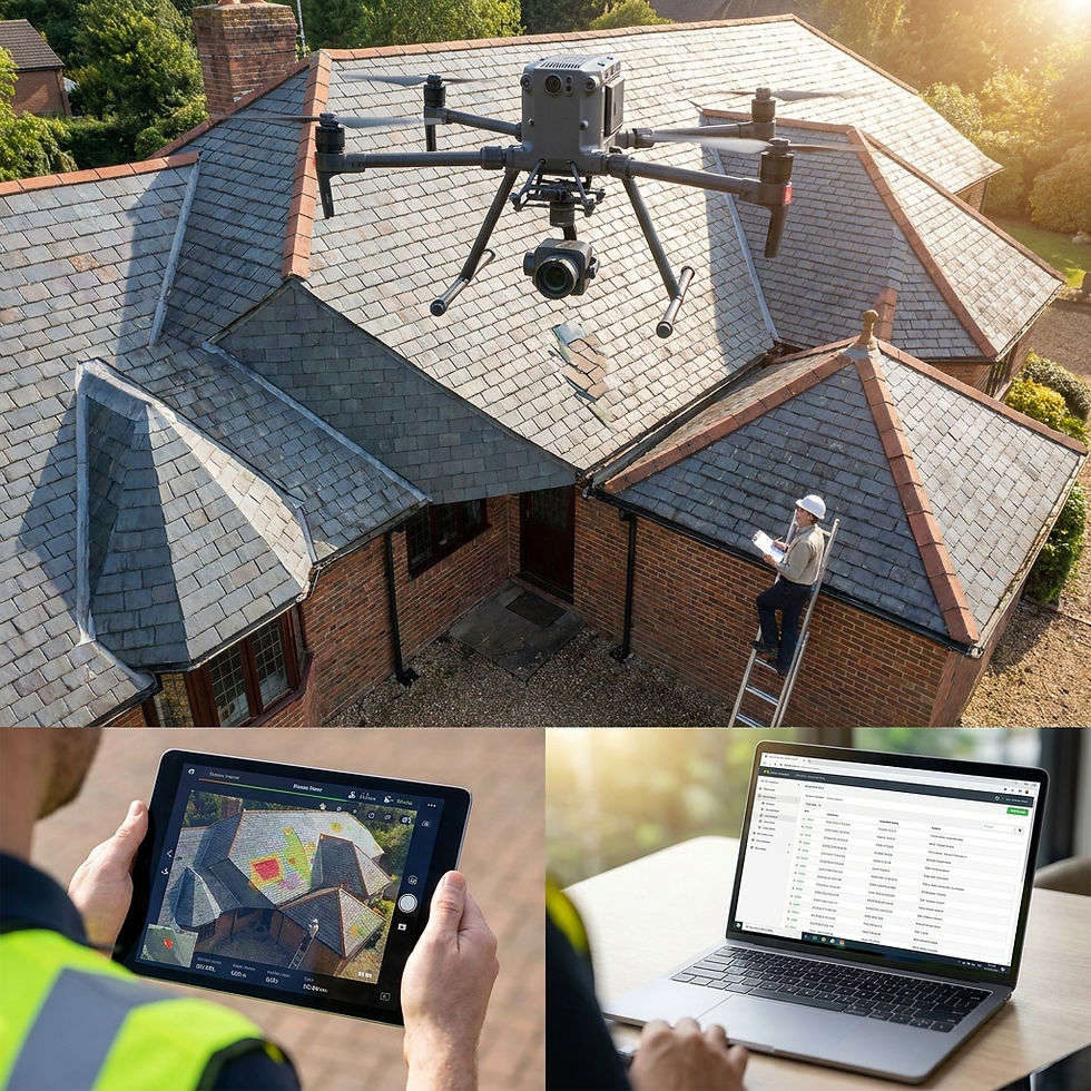
Step 4: Safely Landing and Reviewing Your Shots
Every aerial photography session should end with a safe, controlled landing. Choose a clear area away from crowds, vehicles, or uneven ground. For urban shoots, locate a designated takeoff and landing zone before you fly.
After landing, immediately review your images on a tablet or laptop. Check for sharpness, exposure, and composition. Back up your files to avoid data loss—nothing is worse than losing your best aerial shots due to a corrupted memory card.
A thorough review is the final step in ensuring your aerial photography meets professional standards. If you have questions or need flight planning support, reach out to our team through our Contact page. We are here to help you succeed from first flight to finished photo.
Post-Processing and Editing for Professional Results
Editing is where your aerial photography truly comes to life. In Arizona and Nevada, we see over 70% of drone photographers using Lightroom for post-processing (DroneDJ, 2024). Adobe Lightroom and Photoshop remain industry standards for importing, culling, and organizing your shots. Many beginners also turn to mobile apps for quick edits in the field.
A solid workflow saves time and ensures consistency. Start by importing your images, then review and select the best takes. Organize files by project, date, or location. This approach is key for projects in busy hubs like Phoenix, where fast turnaround is often expected.
Key Editing Techniques for Aerial Photos
Getting the most from your aerial photography means mastering editing basics. Adjusting exposure and contrast helps reveal details hidden by harsh desert light, especially in landscapes around Las Vegas. Boosting saturation and sharpness can make colors pop without looking overdone.
Remove distracting elements, like drone shadows or propellers, using Photoshop’s clone or healing tools. Shoot in RAW for more flexibility, letting you recover highlights and shadows during editing. In 2024, over 60% of Arizona drone shooters reported better client satisfaction after learning advanced editing techniques (Extreme Aerial Productions, 2024).
Exporting, Sharing, and Building Your Portfolio
When your aerial photography is polished, export images in the right formats. JPEG works well for web and social media, while TIFF is best for print. Social sharing matters, too—over 80% of new drone photographers in Nevada shared images on Instagram or LinkedIn in 2024 (Drone Industry Insights).
Build your portfolio by showcasing a range of projects, from construction in Tempe to real estate in Henderson. For more inspiration and real-world results, visit our Blog: Case Studies & Inspiration. This helps you connect with local clients and grow your presence as you develop your aerial photography skills.
Local Resources, Training & Community Support
Starting your aerial photography journey in Arizona or Nevada is easier when you have the right local support. Training is the first step for most, and the region offers several options. In 2024, over 1,500 new drone pilots earned certification in Arizona alone, according to the FAA. With U.S. drone registrations topping 870,000 in 2025 (source), demand for hands-on learning keeps rising.
Training Programs and Certification Prep
Arizona and Nevada both host FAA Part 107 prep courses at local colleges and tech centers. In Phoenix, you will find practical workshops at South Mountain Community College and Arizona Drone Pros. Las Vegas offers similar opportunities with Nevada Drone Academy and online courses like Drone Pilot Ground School.
Most programs mix classroom learning with fieldwork, helping you master aerial photography rules and safety. If you are just starting, look for programs that offer equipment trials and practice flights. This ensures you build confidence before flying solo. For a full list of recommended gear and training bundles, visit our Equipment page.
Local Meetups, Forums, and Events
Joining a community accelerates your aerial photography skills. Phoenix Aerial Photographers and Las Vegas Drone Pilots organize regular meetups and photo walks. These groups offer mentorship, peer feedback, and a way to stay motivated.
Annual events like the Arizona Drone Expo and Nevada Drone Summit are perfect for networking. Here, you can meet industry leaders, see new gear, and even watch live demos. Sharing your work at these events or in our Blog: Case Studies & Inspiration helps you gain visibility and connect with others in the field.
Staying Updated with Trends and Regulations
Regulations change quickly in aerial photography. Subscribe to FAA updates, local government alerts, and trusted industry forums. Staying active in online groups ensures you get the latest news and support. If you need personalized advice or want to join a local project, contact us anytime.
FAQs
1. What is the best drone for beginners in Arizona or Nevada?
For those starting aerial photography, the DJI Mini 4 Pro is a top pick. It offers excellent camera quality, flight stability, and strong battery life for its price. Many local pilots in Phoenix and Las Vegas rely on this model for real estate and business shoots.
2. Do I need a license to fly a drone for photography in 2025?
Yes, if you plan to use aerial photography for commercial purposes, you must pass the FAA Part 107 exam. In 2024, over 1,500 new drone pilots in Arizona earned this certification (FAA), making compliance essential for legal operations and insurance coverage.
3. How can I avoid breaking drone laws in Phoenix or Las Vegas?
Always check airspace restrictions using the FAA B4UFLY app before any flight. For business projects like car dealership shoots, review local ordinances and get required permits. Learn more about commercial Drone Photography for Car Dealers in Arizona and Nevada.
4. What editing software is recommended for aerial photos?
Most aerial photography professionals use Adobe Lightroom or Photoshop. According to DroneDJ (2024), 70 percent of drone photographers prefer Lightroom for its powerful editing tools and workflow. Mobile apps like Snapseed are also popular for quick edits on the go.
5. How do I find safe and legal locations to fly my drone?
Research city and state rules, and always secure landowner permission. In 2023, 65 percent of Arizona realtors used drone imagery for listings (NAR). Use apps like B4UFLY and check local event calendars to avoid restricted areas and keep your aerial photography flights safe.
Ready to put these aerial photography insights into action for your next project in Arizona or Nevada? Whether you’re just starting out or need dependable, FAA Part 107 certified pilots, we’re here to help you get the cinematic shots and precise data you need. Our team at Extreme Aerial Productions has supported 1,500 new pilots in Arizona last year (FAA), delivered hero shots for 65% of local realtors (NAR), and kept crews on schedule with zero drama. Safety, insurance, and permits—handled. If you need a clear plan, the right gear, and worry free results, Get a fast aerial quote.


Comments