


Solar Panel Drone Inspection: A Practical Guide for Site Owners
A solar panel drone inspection uses a thermal camera and a standard camera, flown over an array, to find failing modules, strings and connections without sending anyone onto the rows. It tells you where to send a technician and what to fix first. It does not replace electrical testing, and a good report says so.
We run these surveys across Arizona and Nevada, and the pattern is consistent. Owners call us because production dropped and nobody can say where. They want a map of the problem, not a pile of images. This guide covers how the work runs, what conditions it needs, what you should receive, and how to decide when to schedule it.
Project Snapshot: A Solar Plant Survey in the Nevada Desert
A thermal survey of a utility-scale site near Las Vegas is a good picture of how this work goes in practice. We have written up a similar job in our dry lake solar thermal inspection case study, and the shape of the work repeats from site to site.
The client problem is usually a gap between expected and actual output on a few inverters, with no clear cause. The constraints are predictable: heat, wind, glare, a narrow window of useful sun, and an operator who needs the plant to keep producing during the flight.
Here is the general profile of a job like this, described from how we plan and fly it:
Location and industry: Las Vegas, Nevada, utility-scale and commercial solar
Deliverables: thermal orthomosaic, RGB orthomosaic, geotagged anomaly list, and a summary report
Airspace: checked before each flight, with authorization requested when the site sits in controlled airspace
Turnaround: field capture first, then processing and review, with timing set at quoting based on site size
Constraints: irradiance, wind, array layout, and limits on access to the site
We do not publish invented numbers for a job we did not fly. If you want figures from a comparable site, ask us for them when you request an estimate.
Why Site Owners Schedule a Drone Survey
Owners schedule a solar panel drone inspection to find underperforming equipment faster and with less risk than a walk-down. A technician on foot covers a fraction of a large array in a day and sees only what the eye can see. A thermal camera sees heat, and heat is where most electrical faults show up first.
The reasons we hear most often:
Output is below the model and the cause is unknown.
A warranty claim needs documented, located evidence.
A buyer or lender wants a condition report before a sale or refinance.
A site is recently commissioned and needs a baseline.
Storm, dust, or a vegetation event may have damaged modules.
For rooftop owners, the same logic applies at smaller scale. Commercial roofs with arrays are covered in our rooftop thermal inspection write-up, and roof condition under the panels often matters as much as the panels.
What Happens During a Solar Panel Drone Inspection
The work runs in five steps, and each one affects whether the data is usable. Skipping the early steps is how owners end up with images they cannot act on.
Scout and airspace. We review the site layout, nearby airports, and any controlled airspace. We handle authorization where it is needed, and flights run under FAA Part 107.
Flight plan. We set altitude, overlap, and camera angle for the module type and row spacing. Viewing geometry matters, because a bad angle produces reflections that look like faults.
Capture. We fly thermal and RGB passes, logging irradiance, ambient temperature, and wind at the time of flight.
Processing. Thermal and visual imagery are stitched and georeferenced so each finding lands on a specific module or string.
Review and report. A pilot and analyst classify each anomaly and list what needs ground verification.
Our solar plant PV inspection service covers thermal surveys and LiDAR mapping for solar farms and power infrastructure, and the process above is how we run it.
Field Note: Why We Fly Thermal and RGB Together
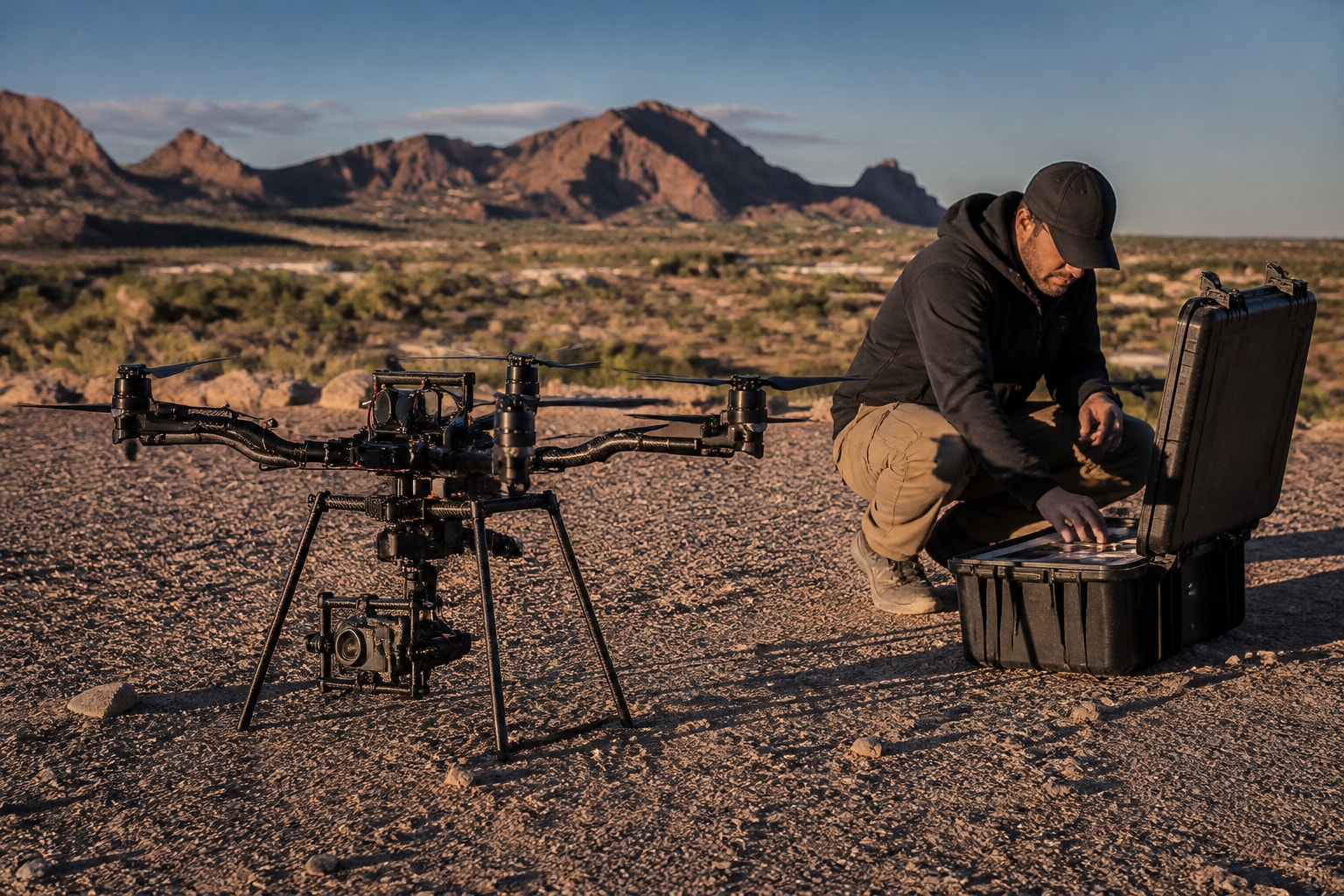
Mark and the team fly both sensors on the same mission, not thermal alone. A hot module with a visible crack, soiling, or a bird nest tells a different story than a hot module that looks clean. Pairing the two images cuts the guesswork before a technician drives out, and it makes the report easier to defend in a meeting.
Conditions That Make or Break the Data
Thermal data is only reliable when the sun is strong enough to load the cells and the air is calm enough to avoid false readings. Thermography works best when irradiance is strong, and the inspection method and standard you follow should set the actual conditions, according to AUAV.
Image quality also depends on sensor setup, viewing geometry, and environmental conditions, as covered in a European Commission BUILD UP article on solar maintenance and diagnostics. In the Southwest, that translates into a few habits:
Fly near solar noon in clear sky, when modules are under load.
Avoid flights after dust events or heavy haze, which dampen readings.
Watch wind, since gusts cool modules and shift the camera angle.
Plan angles to avoid sun glint off glass.
Log conditions for every flight so findings can be compared later.
Summer in Phoenix and Las Vegas gives plenty of irradiance, but heat limits crew hours and battery performance. We schedule early starts and keep spare batteries staged in shade.
What a Usable Report Contains
A usable report places every anomaly on a map, classifies it, and states what is confirmed and what still needs a ground check. If a vendor hands you a folder of raw thermal images, you have data, not an inspection.
Here is what we deliver for a solar survey:
Item | What it tells you |
Thermal orthomosaic | Heat patterns across the full array |
RGB orthomosaic | Visual context for each finding |
Geotagged anomaly list | Exact module or string location |
Anomaly classification | Hot spot, string offline, bypass diode, soiling, other |
Conditions log | Irradiance, temperature, wind at flight time |
Verification list | Findings that need electrical testing |
Practitioners draw a line between simplified and authoritative inspections, and a detailed survey planning guide from Drone Media Imaging is clear about how conditions and reporting affect that distinction. Standards-oriented thermography, as described by Solarthermografie, also relies on anomaly mapping and documented operating conditions.
What a Drone Cannot Confirm
A drone finds abnormal heat. It does not name the cause on its own. Drone thermography is primarily a screening and diagnostic method, and some findings need ground-level electrical testing or physical inspection to confirm the cause, per AUAV.
This answers a question we hear often: can you use a multimeter to test a solar panel? Yes, a multimeter can check open-circuit voltage and basic continuity on a module or string, and a technician will often use one to confirm a drone finding. It does not replace a proper I-V curve test for performance, and it should only be done by someone trained to work with live DC.
The practical sequence is simple. We map and classify. Your O&M crew or electrician verifies the highest-priority items. Repairs get logged, and a follow-up flight confirms the fix. That loop is what turns a survey into lower downtime.
Cost, Timing, and Scheduling Your Solar Panel Drone Inspection
Cost and timing depend on array size, site access, and the deliverables you need. We price a solar panel drone inspection after reviewing the layout, module count, and whether you want thermal alone or thermal plus LiDAR or RGB mapping.
A few points help you plan:
Frequency. Many owners schedule a baseline at commissioning, a yearly survey, and extra flights after storms, outages, or inverter alarms.
Season. Spring and fall in Arizona and Nevada give strong sun with more workable temperatures than midsummer.
Access. Tell us about gate rules, lockout procedures, and operator contacts early.
Pilot pay. If you are wondering what drone roof inspectors make, that is a question about employment, not about hiring a service, and pay varies widely by region and experience.
For a wider view of how drones fit into asset upkeep, our drone inspections for asset management post covers recurring survey programs.
Choosing a Provider You Can Trust With Your Site
Choose a provider on credentials, process, and the quality of the report, not on a low flight price. Ask for proof of Part 107 certification, aircraft registration, and Remote ID compliance where it applies, along with controlled-airspace authorization when your site needs it. AUAV advises checking all of these for U.S. commercial work.
Extreme Aerial Productions has flown commercial missions since 2014, and our pilots hold Part 107 certification. Every flight is covered by insurance. Our clients include Invergy, McCarthy, and QCells, and we serve Arizona and Nevada, with primary bases in Phoenix and Las Vegas.
Questions to put to any vendor:
What sensor and resolution will you fly, and at what altitude?
How do you log irradiance and wind during capture?
Will findings be mapped to module or string level?
What do you flag for ground verification?
How soon will I have the report?
If you run roofs as well as arrays, our drone roof inspection page explains how we document the surface under the panels.
FAQ
What is the 20% rule for solar panels?
The 20% figure is not something a drone survey measures. Definitions vary by installer and design guide, so ask your designer which assumption they mean.
How often should a solar site be inspected by drone?
Most owners fly a baseline at commissioning and then repeat yearly. Extra flights make sense after storms, outages, or a sudden drop in output on specific inverters. The right schedule depends on site size, warranty terms, and your O&M contract.
Can a drone inspection replace electrical testing?
No. A drone locates abnormal heat and classifies likely causes, and a technician confirms the fault with electrical testing. The two work as a pair, and the report should list which findings need a ground check.
Start by pulling your last 12 months of inverter and string-level output data and flagging the strings that trail the rest, because that gives a survey a clear target. We then plan the flights, handle airspace and permits, and deliver a mapped report your crew can act on through our Solar and Power Plant Drone Inspection service. If you want a flight plan and a price for your array in Arizona or Nevada, Get an Estimate from our team and we will scope the survey with you.


Comments