


Aerial Real Estate Photography Results | AZ & NV Services
A Phoenix luxury home developer came to us in March 2026 with a problem: their top-tier listings needed to stand out in a crowded market where every brokerage now uses drones, but their current vendor delivered flat, same-angle shots that failed to showcase the architecture or the surrounding desert mountain views. They needed footage that would make buyers stop scrolling and request a showing. We delivered a 90-second cinematic tour combining smooth orbital reveals, a dynamic FPV interior flythrough, and a golden-hour pull-back that framed the home against Camelback Mountain. The listing went live April 2, 2026, and generated 47% more inquiries in the first week compared to their previous three listings, closing escrow 11 days faster than market average.
Project Snapshot: North Scottsdale Luxury Listing
We flew this job in North Scottsdale on March 28, 2026, targeting late afternoon light to maximize shadows and depth across the modern desert architecture. The client needed both cinematic aerials for marketing and a detailed site overview showing property lines, landscaping zones, and access points for the buyer's landscape architect.
Deliverables included:
90-second edited cinematic tour (4K, color graded, licensed music)
12 high-resolution still images (twilight and daytime)
FPV interior/exterior transition shot
Orthomosaic map at 1-inch GSD covering 2.3 acres
Annotated site plan showing setbacks and easements
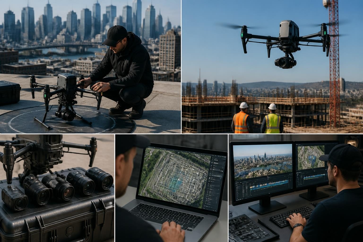
We deployed our DJI Inspire 3 with X9-8K gimbal for the cinematic work and switched to a Mavic 3 Enterprise with RTK for the mapping pass. Total flight time was 38 minutes across two batteries. Airspace coordination was straightforward since we operated under Class G, but we filed LAANC through the Phoenix Sky Harbor grid to ensure clean clearance. Turnaround was 72 hours for edited video and stills, five days for the ortho and annotated plan.
The primary constraint was wind: gusts hit 18 mph by 5:00 PM, so we prioritized the hero shots first and completed the mapping grid earlier in the session when conditions were calmer.
Why Aerial Real Estate Demands More Than Standard Drone Work
The term "aerial real estate" now covers everything from $300 quick-turn listing photos to $15,000 development marketing campaigns with multiple site visits, progress documentation, and data products surveyors and engineers rely on. Understanding what you actually need prevents both overspending and underdelivering.
Marketing aerials for residential listings typically require 8-12 edited stills and a short video (60-90 seconds) that shows the home, yard, neighborhood context, and nearby amenities like parks or golf courses. According to the National Association of REALTORS® 2024 Technology Survey, 83% of buyers found photos and videos very useful when searching for a home online, and listings with aerial imagery receive 68% more views than those without. You want smooth, stabilized moves that won't trigger motion sickness and colors that match the listing photos your ground photographer delivered.
Commercial and development projects add complexity. You're not just selling a visual; you're documenting progress, verifying site conditions, or providing spatial data for zoning, permitting, or construction coordination. This work often requires orthomosaics, contour maps, volumetric calculations, or LiDAR point clouds. We've delivered drone 3D mapping services for mixed-use developments in Las Vegas where the GC needed monthly progress orthos to compare against the baseline topo, and the marketing team needed cinematic B-roll for investor presentations. Same site, different outputs, different flight plans.
Matching the Rig to the Result
Choosing the right platform and sensor separates usable deliverables from expensive do-overs. For high-end residential real estate drone photography, we default to the Inspire 3 with the X9-8K or Zenmuse X7 when the project needs broadcast-quality footage or the ability to punch in during post without losing resolution. The interchangeable lenses let us match focal length to the shot: a 24mm equivalent for wide establishing aerials, a 35mm or 50mm for tighter architectural details that emphasize design lines.
For mapping and data capture on larger sites (5+ acres, grading projects, drone surveying in Nevada), we use the Mavic 3 Enterprise RTK or Phantom 4 RTK. The onboard RTK module connects to local CORS networks or our own base station, delivering centimeter-level positional accuracy without needing dozens of ground control points. This matters when you're producing an orthomosaic that an engineer will use to design a drainage plan or a surveyor will reference for boundary verification.
Platform | Best Use Case | Key Advantage | Typical Turnaround |
Inspire 3 + X9-8K | Luxury listings, commercial marketing | 8K raw, interchangeable lenses, cinematic range | 48-72 hours (edited video) |
Mavic 3 Enterprise RTK | Orthomosaics, site progress, topographic surveys | RTK precision, fast deployment, PPK capability | 5-7 days (processed ortho + contours) |
FPV Custom Rig | Interior tours, unique POV shots | Immersive motion, tight spaces | 72 hours (edited sequence) |
We also keep thermal inspection drones and LiDAR rigs on standby for commercial roof assessments and terrain modeling under heavy tree canopy, though those fall outside typical aerial real estate marketing.
Real-World Applications Across Property Types
Aerial real estate spans residential, commercial, industrial, and land development. Each segment has distinct needs, timelines, and success metrics.
Residential Listings and Luxury Homes
Standard single-family listings benefit from 8-12 stills and a 60-second overview. Luxury properties (above $1.5M in Phoenix and Scottsdale, $2M+ in Summerlin and Henderson) justify more elaborate production: multiple time-of-day shoots, FPV interior sequences, and neighborhood context shots showing proximity to hiking trails, country clubs, or mountain preserves.
A Scottsdale broker we work with schedules twilight shoots for every listing over $3M. The combination of interior lights, landscape lighting, and the deep blue sky just after sunset creates a premium look that daytime-only packages can't match. We shoot two sessions: late afternoon for sunlit exteriors and pool areas, then return 90 minutes before full dark for the twilight stills and a slow pullback that reveals the home against the city lights.
Turnaround is typically 48 hours for edited stills, 72 hours if video is included. The broker uploads the content to MLS, Zillow, and their own site simultaneously, maximizing the first-week traffic surge that drives showings.
Commercial and Mixed-Use Development
Commercial aerial real estate often serves dual purposes: marketing to tenants or buyers and progress documentation for stakeholders, lenders, or municipal inspectors. A 120-unit multifamily project we covered in Henderson from May through September 2026 required monthly site visits. Each visit produced a cinematic progress reel for the developer's investor updates and a georeferenced orthomosaic showing foundation progress, utilities rough-in, and vertical construction against the planned timeline.
The orthos were processed to match the project's state plane coordinate system and delivered as GeoTIFF files the civil engineer imported directly into AutoCAD Civil 3D. This let the team overlay design drawings, verify grading, and catch a drainage issue near Building C before the slab pour. That single catch saved an estimated $48,000 in rework and schedule delay.
For these jobs, we follow USGS guidelines for calibration and QA/QC to ensure our imagery meets the accuracy standards engineers and surveyors expect. Ground control is placed at known benchmarks, and we validate the processed ortho against independent checkpoints before delivery.
Land Sales and Raw Acreage
Selling undeveloped land requires a different approach. Buyers and their consultants need to understand topography, access, utilities, flood zones, and surrounding context. A 40-acre parcel we shot near Anthem in February 2026 included a full orthomosaic, 2-foot contour intervals, and a 3D terrain model the buyer's civil team used to evaluate development feasibility.
We flew 220 images at 75% overlap using the Mavic 3 Enterprise RTK, then processed the dataset in Pix4D to generate the ortho and digital surface model (DSM). The contours were exported as a DXF file and combined with county GIS data showing zoning, easements, and utility corridors. The buyer's engineer used the DSM to run preliminary cut-fill calculations for three different pad layouts, narrowing the design before spending money on a full boundary survey.
This type of deliverable bridges marketing and engineering. The same dataset that helps a buyer visualize the site also provides quantitative data for due diligence. It's a force multiplier when you're competing against other parcels where the seller only provides a plat map and some iPhone photos.
Navigating Regulations, Privacy, and Insurance
Operating legally in aerial real estate means understanding FAA Part 107 regulations, respecting privacy expectations, and carrying appropriate insurance. These aren't optional steps; they're the foundation of a defensible, repeatable workflow.
Part 107 requires remote pilots to hold an FAA-issued certificate, fly only in daylight or civil twilight (with waiver), maintain visual line of sight, and stay below 400 feet AGL unless operating near a structure. In controlled airspace (Class B, C, D, and surface E around major airports), you must obtain LAANC authorization or a manual airspace waiver before flight. Phoenix Sky Harbor, Las Vegas Harry Reid, and Scottsdale Airport all require LAANC coordination for operations within their grids.
We file LAANC requests through the FAA-approved system the night before each shoot, receiving near-instant approval for most residential and commercial real estate sites. For jobs near restricted areas or requiring altitude waivers, we submit manual requests 90 days out. Airspace compliance isn't a courtesy; it's a legal requirement and a client expectation. A detailed breakdown of drone laws in Arizona and Nevada is available for teams managing their own operations.
Privacy and Community Concerns
Aerial real estate photography intersects with privacy in ways ground photography does not. Shooting a luxury home means you're also capturing adjacent properties, sometimes private yards and pools. While no federal law prohibits photographing private property from navigable airspace, some states and municipalities have enacted privacy statutes or nuisance ordinances that apply to drones.
The ACLU's 2026 report on drone policy and privacy highlights growing public concern about persistent aerial surveillance and recommends transparency, notice, and data retention limits. For real estate work, this means notifying neighbors when practical, avoiding unnecessary loitering over private areas, and limiting data retention to what the client needs. We delete raw footage 30 days after final delivery unless the client requests archival storage.
Best practices we follow:
Notify the listing agent and property owner 48 hours before the shoot
Avoid capturing neighboring homes as the primary subject
Fly the minimum altitude and duration needed for the deliverable
Redact or blur identifiable faces or license plates in public marketing content
Store raw data on encrypted drives and delete after delivery
Insurance and Liability
Aerial real estate operators should carry both general liability and hull (equipment) coverage. We maintain $5 million in general liability and $1 million hull coverage, with additional insured endorsements available for clients who require it. According to a 2025 CTSI report on drone liability and insurance, real estate and construction represent the largest share of commercial drone claims, primarily from property damage (contact with buildings, vehicles, or power lines) and privacy disputes.
Clients increasingly ask for certificates of insurance before approving shoots, especially on high-value commercial properties or active construction sites. Having coverage in place and the ability to issue a COI within 24 hours removes friction from the booking process and demonstrates professionalism.
Processing and Delivering Aerial Real Estate Products
Raw imagery is only half the job. The value is in the edited, color-graded, georeferenced, or annotated final product that clients can use immediately.
Video and Still Editing
For cinematic aerial video, we edit in DaVinci Resolve, starting with a rough assembly that matches the shot list, then refining pacing, transitions, and color. Luxury listings get a full color grade to ensure consistent skin tones (if people are included), vibrant but accurate landscape colors, and clean highlights in high-contrast scenes like pools and white stucco.
Music selection matters more than most operators realize. We license tracks through Artlist and Epidemic Sound that match the property's character: modern instrumental for contemporary architecture, softer acoustic pieces for desert or mountain retreats, upbeat tracks for family-oriented suburban neighborhoods. The music sets the emotional tone and pacing, and we always deliver a clean version without music for clients who want to add their own or use the footage in longer compilations.
Still images are processed in Lightroom with careful attention to vertical line correction (critical for architecture), exposure blending for high dynamic range scenes, and color consistency across the set. We deliver full-resolution JPGs and, on request, raw DNG files for clients who want additional editorial control.
Mapping and GIS Outputs
Orthomosaics and terrain models are processed in Pix4DMapper, DroneDeploy, or Agisoft Metashape depending on the project size and accuracy requirements. For jobs requiring survey-grade precision, we use Pix4D with RTK/PPK processing and validate outputs against known control points to meet ASPRS Positional Accuracy Standards.
The ArcGIS Drone2Map workflow is particularly useful for clients already working in Esri's ecosystem. We can deliver orthos as tile packages or hosted feature layers that integrate directly into ArcGIS Online, letting stakeholders view current site conditions alongside zoning maps, utility data, and design plans without switching platforms.
Typical deliverables for mapping-focused aerial real estate projects include:
Product | Format | Common Use Case |
Orthomosaic | GeoTIFF, JPG + world file | Site planning, marketing collateral, overlay analysis |
Digital Surface Model | GeoTIFF, LAS point cloud | Grading design, volumetrics, drainage modeling |
Contour Map | DXF, SHP, PDF | Topographic reference, cut-fill calcs, permit submittals |
3D Mesh | OBJ, FBX | Visualization, stakeholder presentations, VR walkthroughs |
We also provide an accuracy report listing ground control coordinates, residuals, and final RMS error so engineers can assess whether the data meets their project tolerances.
Field Note: Why We Split Marketing and Mapping Flights
Mark, our lead pilot, learned this the hard way on a 2019 Henderson project: trying to capture both cinematic marketing footage and a high-accuracy orthomosaic in a single flight session compromises both deliverables. Marketing needs smooth, dynamic moves and optimal lighting (golden hour, twilight). Mapping needs consistent, nadir (straight-down) images with high overlap, flown in diffuse midday light to minimize shadows.
We now schedule them separately. Marketing flights happen early morning or late afternoon when the light is beautiful and the air is calm. Mapping flights happen mid-morning to early afternoon when the sun is high and shadows are short, reducing false terrain features in the DSM. This separation adds a site visit, but the quality improvement and reduced rework justify the cost. Clients get hero shots that look like feature film stills and maps accurate enough to stake from, both delivered on time.
Emerging Trends and Future Capabilities
Aerial real estate is evolving beyond basic photography and mapping. Machine learning, advanced sensors, and regulatory changes are opening new possibilities for property assessment, valuation, and marketing.
AI-Assisted Analysis and Valuation
Researchers and prop-tech companies are experimenting with computer vision models that analyze drone imagery to estimate property value, identify building features (pool, solar panels, roof condition), and flag maintenance issues. A 2022 study published in the ISPRS Archives demonstrated deep learning models trained on aerial imagery that predicted assessed property values with accuracy comparable to traditional appraisal methods.
While these tools aren't yet mainstream in residential real estate, county assessors and commercial appraisers are piloting programs that use drone imagery as a data source for mass appraisal and change detection. The ability to revisit every parcel in a jurisdiction annually via aerial survey could improve tax assessment equity and catch unpermitted additions or improvements faster than ground inspections alone.
Beyond Visual Line of Sight (BVLOS) and Scaled Operations
Current Part 107 rules require pilots to maintain visual line of sight with the aircraft, limiting how much area you can cover in a single flight. The FAA and TSA's 2025 NPRM on normalizing BVLOS operations proposes a risk-based framework that could allow operators to fly longer missions over large land parcels, master-planned communities, or multi-site portfolios without needing a waiver for each job.
If implemented, this would enable a single pilot to survey a 500-acre ranch or a multi-phase development in one session, dramatically reducing per-acre costs and turnaround time. The FAA's Drone Integration Concept of Operations outlines how Remote ID, detect-and-avoid systems, and performance-based standards will support these advanced operations.
For now, we're monitoring the rulemaking and investing in platforms and training that position us to scale when the rules allow.
Integration with Virtual Tours and Metaverse Platforms
Luxury brokers and commercial developers are combining aerial imagery with 360° ground tours and interactive 3D models to create immersive virtual experiences. A buyer in New York can explore a Scottsdale estate by navigating a Matterport scan indoors, then seamlessly transition to an aerial view that flies them around the property and neighborhood.
We've started delivering 3D meshes optimized for web viewers (Sketchfab, Cesium ion) and VR platforms. These models can be annotated with hotspots linking to floor plans, spec sheets, or neighborhood data, turning passive viewing into an interactive discovery process. Early adopter brokers report longer engagement times and more qualified inquiries from out-of-state buyers who arrive for in-person showings already familiar with the property.
Aerial real estate delivers measurable results when you match the right platform, workflow, and deliverables to your project goals, whether that's faster escrow for a luxury listing or accurate site data for development planning. Since 2014, Extreme Aerial Productions has helped brokers, developers, and commercial teams across Arizona and Nevada turn aerial imagery into competitive advantage with FAA-certified pilots, broadcast-grade gear, and dependable turnaround. Request a quote or schedule a 15-minute planning call and we'll lock your timeline, deliverables, and airspace clearance so your project stays on schedule.


Comments