


Drone Data Isn’t the Upgrade—It’s the Baseline Now

Updated: Aug 6
Drone data didn’t become important overnight. It just stopped being optional.
Across construction sites, roof inspections, and survey workflows, expectations have shifted. Documentation isn’t a bonus anymore—it’s part of how projects are validated, approved, and protected.
At Extreme Aerial Productions, we’ve watched that shift happen in real time. What started as drone real estate photography has moved into full-scale aerial data collection—the kind that decisions are built on, not just presentations.
What Is Drone Data?
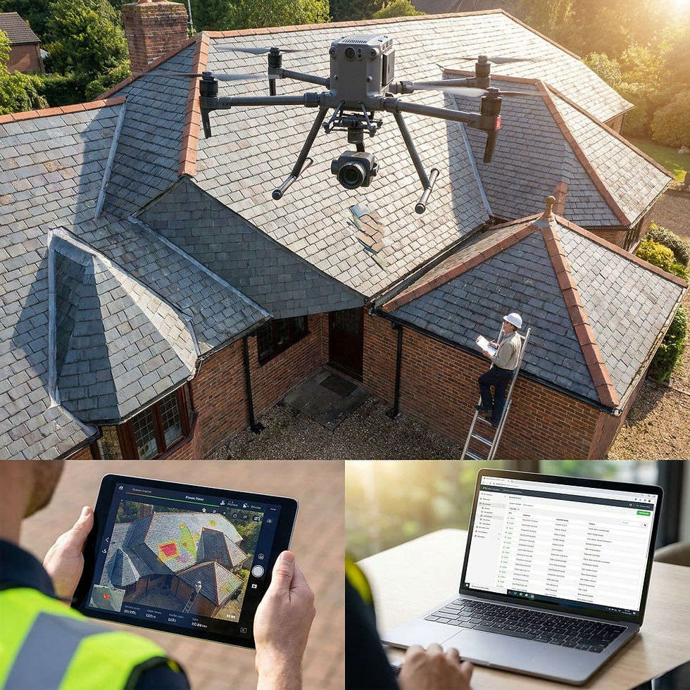
Drone data is the information collected during a drone flight, including imagery, measurements, maps, 3D models, thermal scans, and other deliverables used to document, inspect, measure, and support business decisions. It matters because accurate, repeatable records help reduce risk, improve communication, and create reliable project documentation.
Risk Doesn’t Like Guesswork
Risk doesn’t disappear. It just gets documented—or it doesn’t.
That gap shows up later—usually when it matters most.
Traditional inspections rely on limited vantage points and manual reporting. A drone roof inspection or broader drone inspection services approach provides full coverage, consistent capture, and a record that holds up when questions come later.
We’ve seen it play out: projects with clean aerial records move faster. Projects without them spend more time explaining, defending, and rechecking.
Insurers are paying attention to that gap. Claims supported by aerial documentation are easier to validate because they provide a clear, time-stamped visual record. That reduces ambiguity—and ambiguity is where delays tend to live.
Documentation Is Becoming the Deliverable
It’s easy to think of drones as a capture tool. In reality, the value shows up after the flight.
Raw imagery doesn’t move a project forward. Processed outputs do—and not all drone deliverables are built to support that.
Project Type | Typical Drone Deliverables |
Construction | Orthomosaics, progress reports, 3D models |
Roof Inspections | High-resolution imagery, thermal reports |
Survey Support | Point clouds, contours, orthomosaics |
Insurance | Time-stamped inspection imagery, damage documentation |
Property Management | Progress documentation, inspection imagery |
Through drone mapping services and photogrammetry data processing, images are stitched into orthomosaics, 3D models, and structured datasets that can actually be measured and used. These outputs support planning, verification, and long-term records.
Surveyors increasingly rely on aerial survey services to supplement traditional methods. When paired with LiDAR drone surveying and geospatial data analysis, drone data can deliver detailed site intelligence in a fraction of the time.
The result isn't simply better visibility. It's documentation that can be measured, verified, shared, and relied upon throughout the life of a project.

Accuracy Comes From the Workflow
One of the most common questions is still: how accurate is drone mapping for surveying?
The short answer—accurate enough for many commercial applications, when done correctly.
But accuracy doesn’t come from the drone alone. It comes from the workflow: proper overlap, controlled flight patterns, ground control points, and disciplined processing.
When those elements are in place, drone-based mapping becomes a reliable part of the project record. When they’re not, the gaps don’t show up until later—when timelines are tight, and fixes are expensive.
That’s where experience matters.
Expectations Are Already Changing
There hasn’t been a single moment where drone data became mandatory. Instead, expectations have been shifting quietly—and consistently.
Municipalities are asking for clearer site documentation. Developers expect consistent construction progress documentation. Project partners want standardized deliverables they can actually use. Insurers look for verifiable visual evidence.
Individually, these expectations may seem minor. Collectively, they've changed what clients, insurers, and project stakeholders now consider standard documentation.
Questions like why use drones for construction monitoring are becoming less common. The assumption is that monitoring already includes it. The same goes for the benefits of aerial data for property inspections—they’re no longer theoretical. They’re expected.

The Cost of Waiting
Delaying the adoption of drone data workflows rarely saves time or money. More often, it delays documentation until questions arise—when complete records are hardest to recreate.
Teams already using drone construction monitoring, captured data, and drone inspection services aren’t scrambling to document conditions or verify progress. They already have it.
The rest are catching up mid-project.
That’s a tougher place to be.
The Standard Is Already Taking Shape
Drone data isn’t creeping in. It’s already part of how serious projects are documented, evaluated, and approved.
There’s no single regulation forcing it. But expectations—from insurers, municipalities, and project stakeholders—are moving in one direction: toward consistent, verifiable aerial data as part of normal operations.
If your work depends on accurate, verifiable data, the question isn’t whether to use drone data. It’s whether you’re set up to use it well.
If you want to see how that translates to real-world projects, start the conversation here.


Comments