


Drone Equipment for Arizona and Nevada Projects | Extreme Aerial Productions
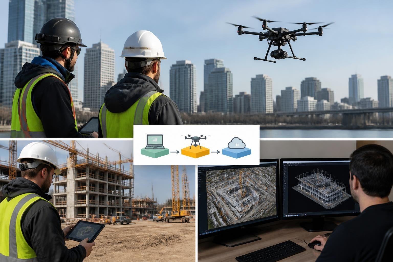
Choosing the right drone equipment decides whether you deliver clean edits on time or scramble to re-fly. We learned this on a Las Vegas Strip construction project in March 2026 when the client needed orthomosaics and progress stills for an investor deck by Friday. The site sat under Class B airspace with crane operations running until 3 PM daily. We brought a Mavic 3 Enterprise with RTK module, coordinated a 3:30 PM-sunset window with ATC, and handed over georeferenced mosaics and 4K stills Thursday afternoon. The client used them in presentations that same week. That project turned on gear selection, airspace planning, and knowing what each sensor delivers under real constraints.
Matching Airframes and Sensors to Project Deliverables
Your drone equipment stack starts with deliverables. Cinematic aerials demand different rigs than survey-grade orthomosaics or thermal inspections. We keep four primary airframes in rotation: Inspire 2 with Zenmuse X7 for hero shots, Mavic 3 Enterprise RTK for mapping, M30T for dual thermal and visible inspection, and FPV platforms for tight interiors and dynamic tracking shots. Each addresses a specific outcome.
For a Phoenix high-rise exterior shoot in January 2026, the director wanted slow reveals and 6K ProRes footage that matched the Red Komodo ground rig. We flew the Inspire 2 with X7 and 24 mm lens, capturing 20 minutes of usable aerials in two batteries. The colorist confirmed footage matched ground cameras without grade gymnastics. That job required a cinema-grade sensor and manual lens control. A mapping drone would have missed the brief entirely.
Mapping projects flip the priority to positional accuracy and coverage efficiency. On a 40-acre industrial site in Henderson, Nevada, in April 2026, the surveyor needed one-inch horizontal accuracy for grading plans. We used the Mavic 3 Enterprise with RTK corrections from a local CORS network, flew at 250 feet AGL with 75% front and side overlap, and delivered orthomosaics and contours within 48 hours. Post-processing with ground control confirmed accuracy within specification. According to the Drone Industry Insights 2025 Enterprise Market Report, 68% of surveying firms now require RTK or PPK for deliverables, up from 52% in 2023. That trend matches what we see in RFPs across Arizona and Nevada.
Key equipment categories we rely on:
Cinema rigs: larger sensors, interchangeable lenses, ProRes or RAW codec support
Mapping platforms: RTK/PPK capability, fixed focal length, automated flight planning integration
Thermal inspection: radiometric sensors, dual-camera systems, spot temperature measurement
FPV and specialty: crash-resistant frames, high frame rates, manual control for dynamic shots
Choosing the wrong category costs time and credibility. A thermal M30T cannot deliver cinema-grade color science. An Inspire 2 cannot provide survey-accurate georeferencing without extensive post-processing.
Sensor and Camera Specifications That Drive Results
Sensor size, resolution, and bit depth determine what you capture and how editors or engineers use it. We select cameras based on the weakest link in the client's workflow. If they deliver to broadcast or cinema, we shoot 10-bit or RAW. If they need tagged inspection imagery for reports, we prioritize metadata and radiometric output over dynamic range.
On a Scottsdale resort renovation in February 2026, the contractor wanted thermal scans of flat roofs to identify membrane failures before re-roofing. We flew the M30T with 640×512 radiometric thermal sensor, logged temperature differentials, and exported annotated reports showing anomalies. The client used those findings to adjust bid quantities and avoid change orders. That sensor provided measurement-grade data, not just pretty heat maps.
Sensor Type | Primary Use | Resolution/Spec | Typical Turnaround |
1-inch CMOS | General aerials, social media | 20 MP stills, 5.1K video | Same day to 24 hours |
Micro Four Thirds | Cinema, commercials, episodic TV | 6K ProRes, 14-stop DR | 24-48 hours (raw footage) |
RTK-enabled RGB | Orthomosaics, topographic surveys | 20 MP geotagged, <2 cm GSD | 48-72 hours with processing |
Radiometric thermal | Roof inspections, solar PV diagnostics | 640×512 or higher, ±2°C accuracy | 24-48 hours with report |
Resolution alone does not guarantee usability. We encountered a project in North Las Vegas in May 2026 where a property owner requested "the highest resolution possible" for a land listing. We explained that 20 MP stills at 200 feet AGL would exceed their web platform's file size limits and slow load times. We delivered 12 MP exports optimized for web, and the listing went live within hours. Understanding the end use saves processing cycles and keeps timelines intact.
Battery and Power Systems for Desert and Extended Flights
Phoenix and Las Vegas summer temperatures push battery performance to the edge. We manage power as carefully as airspace. Intelligent batteries in DJI platforms report cell health and charge cycles, but ambient heat degrades capacity faster than manufacturer specs suggest. On a July 2026 solar farm inspection near Kingman, Arizona, ambient temperature hit 108°F by 10 AM. We pre-cooled batteries in a portable fridge, limited each flight to 18 minutes instead of the rated 25, and rotated six batteries to complete 85 acres. The client received full thermal coverage without a single forced landing.
Lithium-ion battery safety matters in procurement and field handling. We follow UL Research Institutes' guidance on storage, transport, and disposal. Every battery case has fireproof liners, and we never charge unattended. According to a 2024 NTSB safety brief, battery-related incidents accounted for 14% of reported UAS failures in commercial operations, with thermal runaway the leading cause.
Power management practices we enforce:
Inspect batteries before every job for swelling, corrosion, or error codes
Store at 40-60% charge when not in use for more than five days
Charge in ventilated areas away from flammable materials
Rotate stock to retire batteries after 200 cycles or manufacturer threshold
Carry backup batteries equal to 150% of planned flight time
On a Tempe construction time-lapse in August 2026, we mounted a tethered drone system with continuous ground power for 12-hour daily captures over six weeks. That eliminated battery swaps and kept the camera position locked. Tethered systems suit long-duration monitoring when you control the site and can secure power and data lines. For more on that approach, see our tethered drone solutions.
Remote ID, Compliance, and Equipment Integration
As of September 2023, FAA Remote ID requirements apply to most commercial operations. Our fleet includes aircraft with built-in broadcast modules or external Remote ID attachments for legacy platforms. Compliance is not optional, and clients expect proof when they request certificates of insurance and Part 107 documentation. We confirm each airframe broadcasts location, altitude, and control station position before takeoff.
Integration with airspace management tools matters as much as the hardware. We use apps that cross-reference LAANC grids, NOTAMs, and TFRs in real time. On a downtown Phoenix high-rise shoot in October 2026, airspace authorization required coordination with Phoenix Sky Harbor tower. We submitted LAANC requests 48 hours early, received approval for a 400-foot ceiling within controlled airspace, and logged every authorization in our flight records. According to the FAA's 2025 UAS Operations Report, LAANC processed over 1.8 million authorizations nationwide in 2024, a 22% increase from 2023. That system depends on accurate equipment specs and position reporting.
For background on regulatory frameworks shaping equipment standards and operational integration, EASA's U-Space guidance offers a European perspective on unmanned traffic management and UTM services that parallel U.S. developments.
Gimbal Stability and Lens Selection for Cinematic Work
Stabilization determines whether footage makes the final cut. We use three-axis gimbals on all cinema rigs, and we test every platform under windy conditions before booking it for a key day. On a commercial shoot in Paradise, Nevada, in March 2026, sustained 18 mph winds gusted to 25. The Inspire 2's gimbal held the X7 steady through slow pans and tilt reveals. The editor used 90% of our takes. A lesser gimbal would have introduced micro-jitter that ruins slow-motion or locked-off shots.
Lens choice pairs with sensor and altitude. We carry 16 mm, 24 mm, 35 mm, and 50 mm lenses for the X7. Wide lenses suit establishing shots and tight spaces. Longer lenses compress perspective and isolate subjects. On an FPV tracking shot through a Phoenix warehouse in April 2026, we flew a GoPro rig at 11 mm equivalent to capture immersive POV without distortion. The client used it as the opener for a corporate capabilities reel. Matching focal length to creative intent makes the difference between generic aerials and sequences that earn repeat bookings.
Mapping Sensors and Photogrammetry Workflows
Survey-grade deliverables start with the right sensor and flight parameters. We rely on fixed-focal-length RGB cameras with known calibration for photogrammetry. The Mavic 3 Enterprise's 4/3 CMOS sensor and mechanical shutter reduce rolling shutter artifacts during high-speed capture. On a 60-acre grading project in Chandler, Arizona, in June 2026, we flew 220 feet AGL at 15 mph, captured 840 images with 80% overlap, and processed a 1.2 cm GSD orthomosaic in Pix4D. The civil engineer used it to calculate cut-and-fill volumes within 1% of ground truth. That accuracy came from equipment choices and flight discipline, not post-processing magic.
For multispectral or thermal mapping, sensor fusion adds complexity. Recent research on multispectral imaging and object detection explores how combining RGB and thermal bands improves feature extraction and anomaly detection. We have deployed dual-sensor rigs for solar PV inspections, overlaying thermal anomalies onto RGB orthos to pinpoint defective panels. That workflow requires synchronized shutters and matched ground sample distances across sensors.
Flight planning variables that affect data quality:
Ground sample distance (GSD): Lower altitude yields finer detail but longer flight time
Overlap: 75-80% front and side overlap ensures sufficient tie points for dense reconstruction
Shutter speed: Fast shutter minimizes motion blur; we target 1/1000s or faster in bright conditions
Flight speed: Slower speed reduces blur and improves overlap consistency
Lighting: Overcast or consistent sun angles prevent shadows that confuse photogrammetry algorithms
We brief clients on these trade-offs during project scoping. For an example of how we structure UAV aerial mapping deliverables, see our mapping overview.
Inspection Payloads and Specialized Equipment
Thermal, LiDAR, and zoom cameras extend what drones can document. On a Tucson telecom tower inspection in September 2026, the client needed close-up imagery of microwave dishes at 180 feet without climbers. We flew the M30T with 56× hybrid zoom, captured detailed stills of mounting hardware and cable runs, and delivered annotated reports within 24 hours. The client identified corrosion and scheduled repairs without a single tower climb. That job saved thousands in rigging and labor costs.
LiDAR systems suit projects where photogrammetry struggles-dense vegetation, low-texture surfaces, or vertical facades. We deployed a Zenmuse L1 on a riparian corridor survey near Prescott, Arizona, in May 2026, penetrating canopy to map ground elevation for flood modeling. The surveyor received classified point clouds and bare-earth DEMs that photogrammetry could not produce. LiDAR adds weight, flight time penalty, and processing complexity, but when you need ground truth under trees, it is the only reliable tool.
Payload integration affects flight performance. Adding a thermal camera or LiDAR pod changes center of gravity and reduces battery life. We recalibrate gimbal settings and adjust mission planning to account for payload weight. On a North Las Vegas industrial roof inspection in July 2026, switching from RGB to thermal reduced flight time from 24 to 19 minutes. We planned accordingly and completed the site without extra mobilization.
Backup Equipment and Redundancy Planning
No single point of failure is acceptable on client time. We carry backup drones, batteries, memory cards, and controllers to every shoot. On a downtown Las Vegas nighttime aerial in November 2026, our primary Inspire 2 logged a motor error during pre-flight. We swapped to our backup unit, completed the shoot on schedule, and serviced the first aircraft the next day. The client never knew we had an issue.
Redundancy extends to data. We write to dual SD cards when possible and transfer footage to portable SSDs in the field. We lost zero client data in 2026 because we never rely on a single storage medium. According to a 2025 industry survey by Commercial UAV News, 31% of operators reported at least one data loss incident in the prior year, most due to card failure or user error during transfer.
Our standard backup kit includes:
Complete backup airframe in the same class as primary
200% battery capacity for planned flight time
Spare propellers, ND filters, and lens caps
Duplicate memory cards (128 GB minimum)
Backup controller and mobile device
Portable SSD for immediate offload and redundancy
Clients pay for reliability. When you arrive with the right drone equipment and backups, you eliminate the risk that delays their schedule. For insight into how we manage drone services for construction projects with tight timelines, see our construction overview.
Maintenance, Calibration, and Equipment Lifespan
Drone equipment degrades. We track every airframe's flight hours, crash history, and component replacements. Gimbals need recalibration after hard landings. Propellers develop fatigue cracks. Sensors drift over time. On a Phoenix commercial property shoot in August 2026, we noticed slight horizon tilt in test footage. We recalibrated the gimbal's IMU, re-tested, and confirmed level flight. That 15-minute check prevented unusable footage and a costly re-shoot.
Battery health monitoring goes beyond charge cycles. We use manufacturer apps to log internal resistance and cell voltage variance. When a battery shows imbalance or reduced capacity, we retire it regardless of cycle count. Over our 12-year operational history, we have never had a mid-flight battery failure because we replace aggressively.
Firmware updates require testing before deployment. We learned this the hard way in 2019 when a firmware update altered gimbal behavior mid-project. Now we update in the off-season, test thoroughly, and maintain a known-good configuration for active jobs. NIST's UAS research on standards and testing practices underscores the importance of validation and measurement in maintaining equipment reliability.
Secure Procurement and Cybersecurity Considerations
Where you buy drone equipment matters. We source from authorized dealers to avoid counterfeit batteries and compromised firmware. Supply chain security is now a procurement consideration, especially for government and critical infrastructure clients. The AUVSI secure UAS procurement guidance outlines best practices for vetting suppliers and managing firmware integrity. We follow those guidelines on all acquisitions.
Data security starts with equipment configuration. We disable unnecessary wireless protocols, use encrypted storage, and wipe cards after secure transfer. On sensitive sites-casinos, data centers, defense contractors-we follow client IT policies for device handling and network isolation. One Las Vegas resort client in October 2026 required air-gapped transfer of footage via physical drive delivery. We complied, and we earned a repeat contract because we respected their security posture.
Field Notes: Why We Chose This Workflow and Gear
We have flown everything from consumer quads to heavy-lift hexacopters. The current fleet reflects hard lessons. Mark, our lead pilot, notes: "We retired our heavy-lift platforms in 2022 because mobilization time and risk outweighed the payload advantage. The Inspire 2 delivers 90% of what clients ask for in cinema work, and we can deploy it faster and safer. For the rare job that needs RED-level image quality, we coordinate with ground rigs or specialty operators. Matching gear to the 95% use case keeps us efficient and keeps clients coming back." That philosophy drives every equipment decision we make. We choose reliability, field serviceability, and proven performance over specs that look good in marketing but fail under desert heat and tight turnarounds.
How Advanced UAS Research Shapes Equipment Evolution
Looking ahead, integration challenges and beyond visual line of sight (BVLOS) operations will drive new equipment capabilities. NASA's 2024 aeronautics report discusses research priorities in detect-and-avoid sensors, automated traffic management, and long-range communications. Those technologies will enable extended inspections and automated site monitoring without spotter networks. We are tracking these developments and testing equipment that positions us for expanded operational approvals as regulations evolve.
In 2026, we ran a pilot project with cellular LTE connectivity modules for extended-range inspections near Kingman, Arizona. The gear worked, but regulatory approval for BVLOS in congested areas remains limited. We expect that to change as UTM infrastructure matures and Remote ID verification becomes routine. Equipment choices today should anticipate tomorrow's operational envelope without betting the farm on unproven technology.
Choosing drone equipment is choosing what you deliver and how fast you deliver it. Match sensors to deliverables, plan for desert conditions, carry backups, and keep maintenance rigorous. Since 2014, we have refined our fleet to serve Arizona and Nevada clients who need cinema-grade aerials, accurate mapping, and thermal diagnostics on schedule and within budget. If your next project demands the right rig, the right sensor, and zero surprises, reach out to Extreme Aerial Productions. We will lock the plan, the gear, and the date so you stay on track.
Frequently Asked Questions
What drone equipment do I need for a construction progress shoot in Phoenix? For typical progress documentation, an RTK-enabled mapping platform like the Mavic 3 Enterprise captures georeferenced stills and orthomosaics that integrate into project management software. If you need cinematic overview shots for stakeholder presentations, pair that with an Inspire 2 rig for higher-quality video. We bring both to Phoenix-area construction jobs and match the sensor to each shot list item.
How do I know if thermal equipment is necessary for a roof inspection? Thermal sensors identify moisture intrusion, insulation gaps, and membrane failures that visible-light cameras miss. If your inspection goal is to locate defects before costly repairs, radiometric thermal is essential. We flew dual-sensor thermal and RGB missions on Scottsdale and Las Vegas commercial roofs in 2026, and clients used the data to scope repairs accurately and avoid change orders.
What is the turnaround time for mapping deliverables in Arizona and Nevada? Turnaround depends on site size, required accuracy, and deliverable format. A 40-acre site flown with RTK typically processes to orthomosaic and contours within 48-72 hours. Larger sites or LiDAR point clouds may extend to five business days. We confirm timelines during project scoping and communicate any delays immediately. Our average 2026 turnaround for standard mapping jobs was 52 hours from flight to final deliverable.
Do I need to provide ground control points for accurate mapping? RTK-enabled platforms reduce or eliminate the need for ground control on most projects. We achieve sub-two-centimeter accuracy using RTK corrections from CORS networks across Arizona and Nevada. For critical engineering work or sites without reliable RTK coverage, we place and survey ground control points to ensure specification compliance. We discuss this during the initial call and recommend the best approach for your accuracy requirements.
What backup equipment should I expect a professional drone operator to carry? Any professional crew should arrive with a complete backup airframe, extra batteries equal to at least 150% of planned flight time, spare memory cards, and duplicate controllers. We also carry backup props, ND filters, and portable storage for immediate data redundancy. On commercial shoots and mapping projects, equipment failure is unacceptable. Our standard kit eliminates single points of failure and keeps projects on schedule even when gear issues arise.
Comments