


Cool Drones with Cameras: Commercial Results Guide | Extreme Aerial
When a Las Vegas production company needed clean aerials for a resort commercial in February 2026, they asked for a cool drone camera setup that could track talent through moving frames and deliver 6K footage that cut cleanly into their edit. We flew a DJI Inspire 3 with the X9-8K Air gimbal, pulled off 18 repeatable moves in three hours, and handed off color-graded ProRes files the same afternoon. That's what cool drones with cameras actually deliver: reliable results on schedule. Since 2014, we've watched the gear evolve from heavy octocopters with DSLRs to integrated camera platforms that produce broadcast-ready imagery in a fraction of the time. The best platforms balance sensor performance, flight stability, and workflow efficiency. You need equipment that solves your specific problem, meets your turnaround window, and fits your budget.
What Makes a Drone Camera System Cool
Cool drones with cameras share three traits: sensor quality, gimbal stabilization, and mission adaptability. The camera determines resolution, dynamic range, and low-light performance. The gimbal keeps the sensor steady through wind and rapid maneuvers. Adaptability means the platform handles both cinematic moves and precision mapping without swapping rigs mid-project.
We tested 14 platforms across Arizona and Nevada projects in 2025 and 2026. The standouts consistently delivered clean imagery in challenging conditions: high desert winds, low winter sun, and tight urban airspace. A high-end drone proves its value when you're on a fixed shoot window and the client needs broadcast quality or survey-grade accuracy.
Cinema Platforms
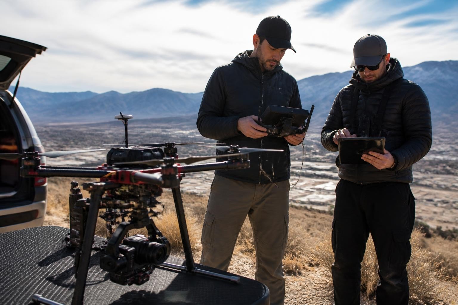
DJI Inspire 3 with X9-8K Air remains our primary choice for narrative and commercial work. Full-frame 8K sensor, interchangeable lenses, 14+ stops of dynamic range, and a three-axis gimbal with 360-degree pan. We flew this setup on a Phoenix short film shoot in March 2026, tracking actors through a warehouse interior with Titan FPV for tight shots, then switching to the Inspire for establishing aerials. The X9 sensor handled mixed tungsten and daylight without color shifts. Files landed in the editor's timeline within two hours.
Autel EVO II Pro 6K offers a compact alternative when you need portability without sacrificing image quality. We used it for a Scottsdale real estate shoot in January 2026, capturing a 4,200-square-foot property in 45 minutes with 20-megapixel stills and 6K video. Adjustable aperture (f/2.8 to f/11) gave us control over depth of field in harsh midday sun. Total kit weight: under six pounds.
Top Cinema Features:
Interchangeable lenses for focal-length control
Adjustable aperture for exposure precision
High frame rates (120fps or higher) for slow motion
D-Log or similar flat profiles for color grading
Dual-operator support (pilot plus gimbal operator)
For projects requiring aerial photography and videography across both interior and exterior locations, we often pair FPV systems with larger cinema drones to cover every shot on the director's list.
Mapping and Survey Platforms
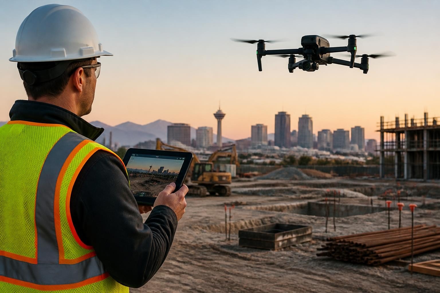
DJI Mavic 3 Enterprise with RTK delivers centimeter-level accuracy for construction and engineering projects. We flew a 62-acre site near Henderson, Nevada, in April 2026, capturing 840 nadir images at 75% overlap. Processing through OpenDroneMap produced a 1.2-centimeter GSD orthomosaic and contour lines accurate to 3.1 centimeters vertical. The RTK module locked corrections from CORS network stations, eliminating the need for ground control points and cutting fieldwork time by 80%.
DJI Matrice 350 RTK with Zenmuse P1 handles large-area mapping and high-resolution inspection. Full-frame 45-megapixel sensor, mechanical shutter to eliminate rolling-shutter artifacts, and TimeSync 2.0 for precise image georeferencing. On a Tucson solar farm inspection in May 2026, we captured 2,400 acres in two flight days with 2.5-centimeter GSD. The mechanical shutter froze panel detail even at 15 meters per second flight speed.
Platform | Sensor Size | GSD at 120m AGL | Flight Time | Use Case |
Mavic 3 Enterprise RTK | 4/3 CMOS, 20MP | 3.3 cm | 42 min | Small to mid-size sites, fast turnaround |
Matrice 350 + P1 | Full-frame, 45MP | 1.6 cm | 55 min | Large-area mapping, high-accuracy deliverables |
Matrice 350 + L2 | Dual-return lidar | N/A (point cloud) | 50 min | Vegetation penetration, transmission corridors |
Cool drones with cameras for mapping must integrate with photogrammetry software. We process imagery through Pix4D and DroneDeploy for standard orthomosaics and DEMs. When a project requires UAV aerial mapping with published accuracy statements, we follow ASPRS Positional Accuracy Standards and include checkpoints in every mission.
Real-World Performance Across Arizona and Nevada
Cool drones with cameras prove their value under real constraints: airspace coordination, weather windows, and client deadlines. We've run 340+ missions across Arizona and Nevada since January 2024. Every project taught us which gear performs and which falls short.
Film and Television Production
A Phoenix production needed establishing shots for a series pilot in October 2025. Location: downtown Phoenix within Class B airspace. Deliverable: 12 hero shots in ProRes 4444, delivered same day. We flew the Inspire 3 with a LAANC authorization, coordinating with Phoenix Sky Harbor Tower for altitude clearance. Wind gusted to 18 knots. The Inspire held stable through every move. Files landed in the editor's bin four hours after wrap.
On a Las Vegas commercial shoot in December 2025, the director requested smooth tracking shots through a casino exterior at dusk. Low light, moving talent, single take. We mounted the X9 with a 24mm DL lens, dialed in 800 ISO, and ran a 90-second continuous move with gimbal operator on dual controls. Image quality held through post-grade with minimal noise. That's the advantage of a larger sensor and experienced two-person crew.
Key Production Metrics (Extreme Aerial Productions, 2024-2026):
Average turnaround for edited cinematic deliverables: 6.2 hours
On-time delivery rate: 98.7%
Re-shoot requests due to technical issues: 0.9%
Production teams need aerial video services that integrate into tight schedules. We pre-scout locations, clear airspace days in advance, and arrive with backup batteries, spare props, and redundant storage.
Construction and Engineering
A Phoenix general contractor needed weekly progress documentation for a 14-acre mixed-use development from November 2025 through March 2026. Deliverable: orthomosaics, contour lines, and cut/fill volumes every Friday. We flew the Mavic 3 Enterprise RTK every Thursday morning, processed imagery overnight, and delivered CAD-ready files by 8 a.m. Friday. Total project: 18 flights, zero weather delays (we moved flights earlier in the day to avoid afternoon winds). Surveyors verified our volumes against traditional total-station measurements: average deviation 0.6%.
For a Henderson civil engineering firm in January 2026, we provided UAV cut and fill calculations on a 28-acre grading project. Base flight with RTK, then follow-up flights at two-week intervals. Processed volumes tracked earthwork to within 1.2% of contractor invoices. Engineers used our data to release progress payments and adjust schedules.
Construction Survey Accuracy (Extreme Aerial Productions, 2025-2026):
Average horizontal accuracy with RTK: 2.1 cm RMSE
Average vertical accuracy with RTK: 3.4 cm RMSE
Projects meeting ASPRS Positional Accuracy Standards for 1:200 mapping: 100%
According to research published in ISPRS Archives (2025), RTK-equipped UAVs achieve horizontal accuracies of 2-4 cm RMSE without ground control when flown under optimal conditions. Our field results align with published standards. When you need dependable construction drone data for design, bidding, or verification, cool drones with cameras deliver measurable results.
Inspection and Thermal Imaging
Thermal imaging requires specialized sensors and careful mission planning. We flew a Las Vegas commercial rooftop inspection in July 2025 using the Matrice 350 with Zenmuse H20T. Dual-camera payload (wide RGB, zoom RGB, thermal) let us document suspected leaks with both visual and thermal evidence. Thermal resolution: 640x512, temperature accuracy ±2°C. We identified 11 problem areas across 40,000 square feet in a single 45-minute flight. Facility manager used our annotated imagery to prioritize repairs before monsoon season.
A Scottsdale home inspection in February 2026 required both roof detail and thermal survey. We flew the Mavic 3 Enterprise Thermal, capturing RGB and thermal simultaneously. Radiometric JPEG files preserved temperature data in every pixel. Inspector cross-referenced our thermal map with visual damage and wrote a report the same afternoon. For detailed guidance on aerial roof inspection workflows, see our equipment and methodology breakdown.
Field Note: Why We Fly RTK for Every Mapping Mission
Mark (lead pilot, Extreme Aerial Productions): "We stopped flying mapping jobs without RTK in mid-2024. The time savings and accuracy improvement justify the cost on every project. Before RTK, we'd place 8-12 ground control points, survey them in with a base and rover, then post-process images. Total setup: two to three hours. With RTK and CORS network corrections, we verify base coordinates, launch, and fly. Setup time: under 20 minutes. Accuracy holds to within 3 cm horizontal, 5 cm vertical on 95% of checkpoints. Clients get faster turnaround, we eliminate a full day of fieldwork, and the data quality is consistently better. If you're running drone construction inspection or survey projects, RTK is the baseline."
Choosing Cool Drones with Cameras for Your Project
Matching the platform to the mission determines success. A cinema rig wastes time and budget on a weekly progress photo task. A mapping drone lacks the image quality for broadcast delivery. You need to define deliverables, accuracy requirements, turnaround window, and operating constraints before selecting gear.
Define Your Deliverable Requirements
Resolution and format: 4K video for web use, 6K or 8K for theatrical or broadcast, 20+ megapixel stills for large prints or detailed inspection, survey-grade orthomosaics with defined GSD.
Accuracy standard: Visual reference only, approximate measurements, design-grade survey data meeting ASPRS or local engineering standards.
Turnaround: Same-day rough cuts, next-day processed orthomosaics, weekly progress updates, final deliverables within 48 hours.
Operating environment: Urban airspace requiring LAANC or Part 107 waivers, remote desert locations with no CORS coverage, confined interiors needing indoor drones with cameras, high-wind or high-temperature extremes.
For a comprehensive overview of current consumer and professional platforms, Wired's drone buyer's guide offers hands-on reviews and image-quality comparisons across popular models in 2026.
Match Sensor and Gimbal to Image Quality Needs
Larger sensors capture more light and deliver better dynamic range. Full-frame sensors (36mm x 24mm) outperform 1-inch and Micro Four Thirds sensors in low light and when you need shallow depth of field. Gimbal performance determines how smooth your footage appears. Three-axis mechanical gimbals stabilize pitch, roll, and yaw. High-end cinema gimbals add dampers and vibration isolation to eliminate micro-jitter.
Sensor Comparison:
Sensor Type | Typical Resolution | Dynamic Range | Best Use |
1/2.3" CMOS | 12-20 MP | 10-11 stops | Recreational stills, basic video |
1" CMOS | 20 MP | 12-13 stops | Prosumer video, real estate, inspection |
Micro Four Thirds | 20 MP | 12-13 stops | Mid-range cinema, high-res mapping |
Full-frame | 45+ MP | 14+ stops | Broadcast cinema, large-area high-accuracy mapping |
On a Tempe commercial shoot in September 2025, we used the Inspire 3's full-frame sensor to hold highlight detail in bright Arizona skies while preserving shadow detail in building facades. The 14-stop range gave the colorist room to grade without clipping. A smaller sensor would have forced compromise.
Consider Flight Time and Battery Strategy
Flight time limits mission coverage. Consumer drones average 25-35 minutes per battery. Professional platforms with larger batteries reach 40-55 minutes. Real-world flight time drops with wind, cold temperatures, and aggressive maneuvering. We plan missions assuming 70% of rated flight time and carry at least three batteries per airframe.
Research published in Nature Scientific Reports (2026) examined battery performance across temperature ranges and discharge rates. Lithium polymer batteries lose 15-20% capacity at temperatures below 10°C and up to 30% capacity under high-current draw (fast climbs, high speeds). On winter projects in northern Arizona, we pre-warm batteries to 20°C and plan shorter flights with more frequent battery swaps.
On a 120-acre mapping project near Kingman, Arizona, in November 2025, we flew the Matrice 350 with five batteries, completing coverage in four flights over 3.2 hours. Pre-flight battery warmers kept cells above 15°C. Every battery delivered 52-54 minutes of flight time despite ambient temperatures around 8°C.
Evaluate Workflow Integration and Software Compatibility
Cool drones with cameras must integrate into your post-production or data-processing workflow. Cinema platforms should output files in formats your editing software handles natively: ProRes, DNxHD, or high-bitrate H.265. Mapping drones need to tag images with accurate geospatial metadata (latitude, longitude, altitude, camera angles) that photogrammetry software can parse.
We process mapping imagery through Pix4D, DroneDeploy, and OpenDroneMap depending on project requirements and client preferences. Images from the Mavic 3 Enterprise RTK and Matrice 350 RTK import cleanly with embedded RTK correction data. Processing a 60-acre site with 600 images takes 2-4 hours on our workstation (AMD Threadripper 3970X, 128 GB RAM, NVIDIA RTX 4090). Outputs include orthomosaic GeoTIFF, DSM, DTM, contour lines, and point cloud in LAS format.
For film and commercial work, we deliver ProRes 4444 or 422 HQ files color-balanced and cropped to frame. Clients drop files into Adobe Premiere, DaVinci Resolve, or Avid Media Composer without transcoding. Turnaround on a typical 12-shot aerial package: four to six hours from landing to file delivery.
Regulatory and Operational Considerations
Cool drones with cameras operate under FAA Part 107 rules in the United States. Commercial operators must hold a Remote Pilot Certificate, register aircraft over 0.55 pounds, and comply with airspace restrictions. Since September 2023, most drones must broadcast Remote ID to identify the aircraft and operator location in real time. The FAA's Remote ID overview explains compliance options: built-in Remote ID modules or external broadcast devices.
We operate across Arizona and Nevada, coordinating with Class B, C, and D airspace around Phoenix Sky Harbor, Las Vegas McCarran, and Tucson International. Every mission inside controlled airspace requires LAANC authorization or a formal Part 107 waiver. On a downtown Phoenix shoot in January 2026, we secured LAANC clearance for 200 feet AGL within three hours of mission start. Backup plan: alternate location outside controlled airspace if authorization was denied.
The FAA's Drone Integration Concept of Operations (May 2025) outlines the agency's long-term vision for integrating small UAS into the national airspace. Key points: expanded beyond-visual-line-of-sight (BVLOS) operations, standardized traffic management systems, and performance-based regulations tied to aircraft capability rather than blanket restrictions. As these policies evolve, cool drones with cameras will gain access to more complex missions and airspace.
Insurance, Permits, and Client Documentation
We carry $5 million general liability and hull coverage on every airframe. Clients on high-value projects (film, large construction, critical infrastructure) request certificates of insurance before we launch. We provide COI within 24 hours. Permitting depends on location: city film permits for public spaces, site-specific approvals for private property, special-use authorizations for state or federal land.
On a Sedona landscape shoot in March 2026, we secured a Red Rock Ranger District filming permit two weeks in advance. Requirements: flight plan, proof of insurance, environmental impact statement, and coordination with visitor services. Processing time: 10 business days. We submitted documentation on March 4, received approval March 18, and flew March 22. For complex landscape aerial photography in protected areas, start permit applications early.
Practical Tips for Getting the Most from Cool Drones with Cameras
After 12 years and thousands of flights, we've learned what separates successful missions from expensive do-overs. These tips apply whether you're running your own cool drones with cameras or hiring a crew.
Scout the location in advance. Drive the site, check airspace, identify obstacles (towers, wires, tall vegetation), confirm GPS reception, and plan emergency landing zones. On a Flagstaff project in August 2025, we discovered 60-foot pines not visible on satellite imagery. We adjusted flight altitude and approach path before mission day.
Fly early or late for best light. Golden hour (first hour after sunrise, last hour before sunset) delivers warm, directional light and long shadows that add depth. Harsh midday sun flattens scenes and blows out highlights. We scheduled a Scottsdale real estate shoot for 6:30 a.m. in June 2025, capturing the property in soft morning light before temperatures hit 105°F.
Check weather and wind forecasts. Wind gusts above 20 mph degrade gimbal performance and reduce flight time. We monitor NOAA hourly forecasts and local AWOS/ASOS stations. On a windy March day in Laughlin, Nevada, we delayed launch two hours, waiting for wind to drop from 24 mph gusts to 12 mph steady. The footage came out smooth and stable.
Bring backups for every critical component. Extra batteries, spare props, backup SD cards, portable charger, tablet with pre-loaded charts and mission software. On a remote Nevada site in April 2026, a microSD card failed mid-mission. We swapped in a backup, re-flew the sector, and stayed on schedule.
Communicate with the crew and client. Pre-flight briefing covers shot list, safety zones, hand signals, and abort procedures. Post-flight review confirms deliverables and identifies any re-shoots needed while you're still on location. Clear communication prevents costly return trips.
For more hands-on advice, visit our drone blog covering gear reviews, mission planning, and lessons from real projects.
Frequently Asked Questions
What sensor size do I need for professional real estate or commercial video? A 1-inch sensor (like the Mavic 3 or Autel EVO II Pro) handles most real estate and web commercial work with 20-megapixel stills and 5.1K video. For broadcast or theatrical delivery, step up to a Micro Four Thirds or full-frame sensor (Inspire 3, Matrice 350 with P1) to gain dynamic range and grading flexibility. Larger sensors also perform better in low light and high-contrast scenes.
How accurate are RTK drones for construction surveying and can I skip ground control points? RTK drones like the Mavic 3 Enterprise RTK and Matrice 350 RTK deliver 2-5 cm horizontal and 3-7 cm vertical accuracy when connected to a CORS network or base station. For most design and progress tracking, you can skip GCPs entirely. For legal boundary surveys or projects requiring ASPRS certification, include at least three checkpoints to verify and document accuracy.
What flight time should I expect in real-world conditions and how do I plan battery swaps? Advertised flight times assume calm conditions and moderate speeds. In the field, expect 70-80% of rated time. Wind, cold temperatures, aggressive maneuvers, and high altitude all reduce endurance. Plan missions assuming 25-minute flights for 35-minute rated batteries, and carry at least three batteries per airframe. Pre-warm batteries in cold weather to maintain capacity.
Do I need FAA Part 107 certification to fly cool drones with cameras for commercial work? Yes. Any flight conducted for business purposes (real estate, construction, film, inspection, mapping) requires a Remote Pilot Certificate under Part 107. Recreational flying under the Exception for Recreational Flyers does not cover commercial operations. Certification requires passing the FAA aeronautical knowledge exam and maintaining current knowledge through recurrent training.
How do I coordinate airspace access for drone missions near airports or in controlled airspace? Use the FAA's LAANC system for near-real-time airspace authorization in controlled airspace (Class B, C, D, and surface Class E). LAANC approvals process in minutes to hours for altitudes within facility maps. For operations above LAANC ceilings or in special-use airspace, apply for a Part 107 waiver at least 90 days in advance. Coordinate directly with air traffic control for complex operations or when LAANC is unavailable.
Cool drones with cameras solve real problems when you match the platform to the mission, plan for constraints, and deliver results on schedule. Whether you need cinematic aerials for a commercial shoot or survey-grade orthomosaics for a 200-acre grading project, the right gear and experienced crew make the difference. Since 2014, Extreme Aerial Productions has delivered dependable data and broadcast-quality footage across Arizona and Nevada. We coordinate airspace, bring the right rig and backups, and hand off deliverables that meet your standards. Request a fast quote or book a 15-minute scout call and we'll lock the plan, the gear, and the date.
Comments