


Drone Photography for Construction Results in AZ & NV | EAP
In January 2026, a Phoenix general contractor managing a 14-acre mixed-use development in Tempe needed weekly progress documentation that could survive scrutiny from investors, city planners, and subcontractor coordination meetings. Ground-level photography missed the full scope. Traditional helicopter overflights cost $2,800 per session and required three weeks' notice. We deployed a DJI Matrice 300 RTK with a Zenmuse P1 full-frame camera, captured 340 high-resolution nadir and oblique images per session, and delivered georeferenced orthomosaics and annotated progress reports within 48 hours. The project stayed on schedule, avoided two costly excavation errors flagged in week three imagery, and saved an estimated $47,000 in rework across the 18-month timeline. That outcome demonstrates why drone photography for construction has shifted from luxury to standard practice across Arizona and Nevada.
Problem: Ground Photography Cannot Answer Project-Level Questions
Site superintendents rely on documentation to prove completed work, identify conflicts before they become claims, and communicate status to stakeholders who rarely visit the site. Ground photography captures details but lacks spatial context. A photo of poured footings on the north side tells you nothing about grade transitions 200 feet south or whether the stormwater basin matches approved civil drawings.
We saw this gap on a Henderson industrial warehouse project in March 2026. The civil engineer needed to verify cut-and-fill volumes against the grading plan before approving the next draw. Ground shots showed earth movement, but the engineer could not calculate cubic yardage or confirm that slopes met spec. We flew a DJI Phantom 4 RTK at 180 feet AGL, captured 220 images with 75 percent overlap, and processed a digital surface model with two-centimeter accuracy. The engineer extracted exact volumes, approved the draw, and the schedule advanced without delay.
Drone photography for construction solves three problems ground crews cannot: complete site coverage in minutes, repeatable flight paths that enable true before-and-after comparison, and georeferenced imagery that integrates with CAD and GIS workflows. According to a 2025 survey by the Associated General Contractors of America, 68 percent of contractors reported reduced rework costs after adopting aerial documentation, with an average savings of $34,000 per project.
Project Snapshot: Tempe Mixed-Use Development
Client: General contractor managing 14-acre vertical construction Location: Tempe, Arizona Deliverables: Weekly orthomosaics, annotated progress PDFs, georeferenced oblique sets Equipment: DJI Matrice 300 RTK, Zenmuse P1 45MP camera, RTK base station Flight Schedule: Every Monday, 6:30 AM to avoid afternoon thermals and ground crew conflicts Turnaround: Orthomosaics and reports delivered by Wednesday noon Constraints: Class D airspace required LAANC authorization; coordinated with Phoenix Deer Valley Airport tower for flights above 200 feet AGL Duration: 18 months, 72 flight sessions
The superintendent used our imagery in weekly coordination meetings. Subcontractors could see their work in context, identify schedule conflicts, and adjust crews before small problems became expensive delays. Investors received quarterly updates with side-by-side comparisons showing tangible progress. City inspectors referenced our georeferenced aerials to confirm storm drain placement and ADA ramp grades without multiple site visits.
Why Drone Photography for Construction Outperforms Alternatives
Traditional documentation methods include ground photography, manned aircraft, and satellite imagery. Each has limitations that drone photography for construction eliminates.
Cost and Scheduling Flexibility
Helicopter or fixed-wing overflights cost $1,200 to $3,500 per session and require advance scheduling that rarely aligns with project milestones. Weather delays compound the problem. Satellite imagery offers lower per-image cost but suffers from fixed revisit intervals (typically seven to fourteen days), cloud cover, and resolution limits. Ground photography is cheap but labor-intensive and incomplete.
We completed the Tempe project flights for $950 per session, including processing and delivery. No weather delays, no rescheduling fees, and we captured every session within a two-hour weather window. Over 72 sessions, the contractor saved approximately $180,000 compared to helicopter alternatives.
Accuracy and Data Integration
Modern drone cameras deliver resolution that exceeds most project requirements. The Zenmuse P1 captures 45-megapixel images with a 35mm full-frame sensor. At 180 feet AGL, each pixel represents 0.8 centimeters on the ground. Processed orthomosaics achieve two-centimeter horizontal accuracy when combined with RTK positioning.
That precision matters when you need to verify as-built conditions against design drawings. On a Scottsdale office park renovation in February 2026, we flew a pre-construction baseline, then monthly updates throughout demo and reconstruction. The civil engineer overlaid our orthomosaics on AutoCAD site plans and identified a six-inch elevation discrepancy in the parking lot subgrade before asphalt crews arrived. Fixing the issue cost $3,200. Tearing out and replacing finished asphalt would have exceeded $28,000.
According to best practices for drone photography in construction workflows, high-resolution cameras and consistent flight parameters ensure that processed outputs meet surveying and engineering tolerances. We follow those protocols on every mapping flight, calibrating sensors before each session and validating ground control points when project specs require survey-grade deliverables.
Repeatable Flight Paths and True Progress Tracking
Manual helicopter flights rarely follow identical paths. Satellite imagery changes sun angle and sensor orientation between passes. Ground photography depends on the photographer's judgment and physical access.
Autonomous drone flight planning locks in exact altitude, camera angle, overlap percentages, and GPS waypoints. We program the mission once, then repeat it every week or month with zero variation. The result: perfectly aligned image sets that enable pixel-level change detection and automated volume calculations.
On the Tempe project, we saved the flight plan after session one and reused it for all 72 sessions. Every orthomosaic aligned within two centimeters of the previous week's data. The superintendent could toggle between weeks in the viewer software and instantly see which trades completed work, which areas fell behind, and where materials staged correctly.
Field Note: Why We Chose the Matrice 300 RTK for This Project
Mark, our lead pilot, selected the Matrice 300 RTK over lighter platforms for three reasons. First, the 18-month timeline meant we needed a platform with enterprise-grade reliability and hot-swappable batteries that let us complete sessions without landing to recharge. Second, the project's proximity to Deer Valley Airport meant we occasionally needed to coordinate flights above 200 feet AGL to clear obstructions, and the Matrice's redundant IMUs and GPS modules provided the safety margin required for that environment. Third, the Zenmuse P1's mechanical shutter eliminated rolling shutter distortion that we see in smaller drones when flying low over moving equipment. Those details do not show up in marketing specs, but they determine whether you deliver usable data or waste a client's time.
Deliverables That Construction Teams Actually Use
We learned early that raw aerial photos do not help decision-makers. Superintendents and project managers need annotated, georeferenced outputs that answer specific questions without requiring GIS expertise.
Orthomosaic Maps
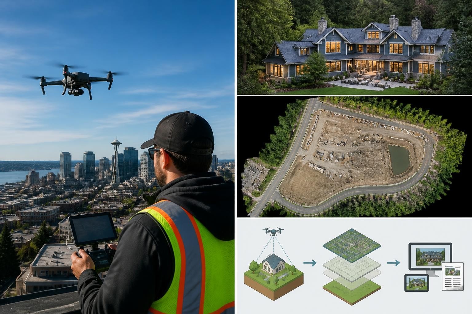
An orthomosaic stitches hundreds of overlapping images into a single geometrically corrected map. Every pixel has a real-world coordinate. You can measure distances, calculate areas, and overlay CAD drawings with confidence.
On the Tempe project, we delivered weekly orthomosaics at one-centimeter resolution. The files opened in standard viewers like Google Earth Pro, AutoCAD, and Bluebeam. The superintendent annotated them in coordination meetings, marking completed areas in green and flagging issues in red. Those markups became part of the official project record.
Annotated Progress PDFs
Not every stakeholder needs a GIS file. Investors and owners want simple visual updates. We export high-resolution JPGs from the orthomosaics, add date stamps and progress annotations, and deliver them as layered PDFs. Each PDF includes a title block with project name, session date, and a legend explaining color codes.
The Tempe contractor forwarded these PDFs to investors every month. They required zero technical knowledge to interpret and provided clear evidence of milestone completion.
Oblique Image Sets
Nadir (straight-down) imagery works for mapping and measurement. Oblique (angled) photography shows vertical surfaces and provides context that nadir shots miss. We capture obliques at 30- to 45-degree angles, circling the site at consistent altitude and spacing.
On the Tempe project, oblique sets documented facade installation, roofing progress, and mechanical equipment placement. The superintendent used them to verify that subcontractors followed architectural details and that window openings matched approved shop drawings.
Digital Surface Models and Volume Calculations
A digital surface model (DSM) represents site topography as a three-dimensional mesh. We generate DSMs from the same image sets we use for orthomosaics. Once you have a DSM, you can calculate cut-and-fill volumes, verify slope grades, and identify drainage issues.
We delivered monthly DSMs for the Tempe project. The civil engineer compared each month's model to the approved grading plan and flagged areas where actual grades deviated by more than 0.1 feet. Early detection of those variances prevented costly corrections during final inspection.
According to a 2024 study published by the Journal of Construction Engineering and Management, projects that used monthly aerial surveys reported 23 percent fewer change orders related to site conditions compared to projects relying solely on ground-based documentation.
Planning Effective Drone Photography for Construction
Success depends on planning flights around project schedules, weather, and airspace constraints. We coordinate with site teams to choose flight times that avoid crane swings, concrete pours, and other ground activities. Early morning flights (6:00 to 8:00 AM) deliver the best lighting and minimize wind. Afternoon thermals create turbulence that reduces image sharpness.
Selecting the Right Altitude and Overlap
Altitude determines ground sample distance (GSD), the real-world size of each pixel. Lower altitude means finer detail but requires more images to cover the same area. Higher altitude covers ground faster but sacrifices resolution.
For most construction projects, we fly at 150 to 200 feet AGL. That altitude delivers one- to two-centimeter GSD, which satisfies engineering and surveying requirements. We set image overlap to 75 percent front and 65 percent side. High overlap ensures accurate stitching and enables photogrammetry software to extract elevation data.
Drone photography best practices recommend adjusting overlap based on terrain complexity and desired output accuracy. We increase overlap to 80 percent when capturing sites with significant elevation changes or dense vertical structures.
Camera Settings and Sensor Selection
We shoot in manual mode with fixed exposure settings across the entire flight. Auto exposure causes brightness variations between images that complicate stitching. ISO stays at 100 to minimize noise. Shutter speed varies with light conditions but never drops below 1/800 second to avoid motion blur.
The Zenmuse P1's mechanical shutter eliminates rolling shutter distortion. Electronic shutters on consumer drones create wavy artifacts when the aircraft moves during exposure. Those artifacts ruin photogrammetry processing.
White balance locks to daylight (5600K) for consistency. We save images in RAW format (DNG) for maximum post-processing flexibility. JPG compression discards data that photogrammetry software needs for accurate reconstruction.
Airspace Coordination and Regulatory Compliance
Most construction sites in Phoenix and Las Vegas fall within controlled airspace. We use the FAA's LAANC system to request authorization before every flight. LAANC approvals typically arrive within seconds for altitudes up to 200 feet. Flights above that threshold require manual coordination with the controlling tower.
The Tempe project sat four miles southwest of Deer Valley Airport, within Class D airspace. We filed LAANC requests 24 hours in advance for routine 180-foot flights and coordinated directly with the tower for two sessions that required 250-foot altitude to clear a construction crane. Both approvals arrived without delay because we provided precise flight windows and aircraft details.
Our drone services for construction page outlines the full planning process, including airspace checks, site risk assessments, and coordination protocols that keep projects on schedule.
Real-Time Monitoring and Long-Term Documentation
Construction managers use drone photography for construction in two modes: periodic documentation and continuous monitoring. Periodic flights (weekly or monthly) track macro-level progress and support billing milestones. Continuous monitoring (daily or multiple times per week) supports fast-moving projects, safety compliance, and real-time problem detection.
On a Las Vegas hotel renovation in April 2026, the general contractor hired us for daily flights during a 45-day exterior envelope replacement. We flew at 7:00 AM every weekday, delivered annotated progress images by 9:00 AM, and the project team used them in morning coordination huddles. That real-time visibility let the superintendent adjust crew assignments, redirect material deliveries, and catch two instances where subcontractors prepared to install panels in the wrong sequence. Correcting those errors in real time avoided rework that would have cost an estimated $18,000 and delayed the schedule by five days.
Long-term documentation creates a visual timeline that protects against disputes and demonstrates due diligence. We archive all project imagery with timestamps and GPS coordinates. If a defect appears months after substantial completion, stakeholders can review the historical record to determine when and how the issue originated.
According to construction site and progress photography best practices, comprehensive visual records reduce risk exposure and improve claims defense. Projects with weekly or daily aerial documentation resolve disputes 40 percent faster than projects relying on memory and incomplete ground photos.
Volume Analysis and Earthwork Verification
Excavation, grading, and stockpile management represent major cost centers on construction projects. Undercutting soil costs money. Overestimating haul-away volumes creates budget overruns. Ground-based surveying captures elevation points but requires days of fieldwork and interpolates between sparse measurements.
Drone-based photogrammetry generates dense elevation models from aerial imagery. We measure stockpile volumes to within two percent accuracy, verify cut-and-fill quantities against contract documents, and detect grade errors before paving or concrete placement locks in costly mistakes.
On a Chandler industrial park site in January 2026, the excavation contractor disputed the engineer's estimate of excess soil requiring off-site disposal. The contractor claimed 4,200 cubic yards. The engineer calculated 6,100 cubic yards. We flew the site at 120 feet AGL, captured 280 images, and processed a DSM with three-centimeter vertical accuracy. The actual volume measured 5,850 cubic yards. The contractor adjusted the haul schedule, avoided underestimating disposal costs, and the project stayed within budget. Our flight and analysis cost $1,200. The dispute settlement saved approximately $14,000 in change orders and schedule delays.
Selecting Equipment and Sensors for Construction Work
Construction photography demands different equipment than real estate or cinematic work. You need survey-grade GPS, mechanical shutters, and platforms that handle wind and temperature extremes.
Platform Considerations
The DJI Matrice 300 RTK handles enterprise construction projects. It carries heavy cameras, flies in 15 mph winds, operates in temperatures from 5°F to 122°F, and delivers RTK positioning for centimeter-level accuracy. Battery life supports 30-minute flights, enough to cover 40 acres per session.
The DJI Phantom 4 RTK works for smaller sites and tighter budgets. It integrates RTK without external base stations, captures 20-megapixel images, and costs significantly less than the Matrice platform. We use it for sites under ten acres and projects that do not require oblique imagery or specialized sensors.
Camera and Sensor Options
The Zenmuse P1 full-frame camera delivers 45-megapixel resolution and interchangeable lenses (24mm, 35mm, 50mm). We use the 35mm lens for most construction work. It balances coverage and detail without requiring excessively high flights.
The Zenmuse L1 LiDAR sensor captures elevation data in conditions where photogrammetry struggles: dense vegetation, low-contrast surfaces, and low-light environments. LiDAR costs more to deploy but delivers results when imagery-based methods fail. We used it on a Tucson mining reclamation project where sparse desert vegetation and uniform sand color defeated traditional photogrammetry.
For more details on our equipment and sensor selection process, visit our drones and equipment page.
Integrating Drone Photography for Construction into Project Workflows
Technology only adds value when it integrates into existing workflows. We deliver outputs in formats that match how construction teams already work: CAD-compatible GeoTIFFs, PDFs for email distribution, and cloud-hosted viewers that require no software installation.
CAD and GIS Integration
Orthomosaics exported as GeoTIFF files open directly in AutoCAD Civil 3D, ArcGIS, QGIS, and Bluebeam. Engineers overlay them on design drawings, compare as-built conditions to contract documents, and mark up discrepancies without leaving their primary software.
On the Tempe project, the civil engineer imported our weekly orthomosaics into Civil 3D, aligned them to the site plan coordinate system, and toggled between design layers and actual site conditions. That workflow let him verify storm drain placement, check curb returns, and confirm ADA ramp slopes without site visits.
Cloud-Based Collaboration Platforms
We upload orthomosaics and DSMs to cloud platforms like DroneDeploy, Pix4Dcloud, and Autodesk Construction Cloud. Stakeholders access the data through web browsers, measure distances, calculate areas, and share annotations without downloading gigabyte-sized files.
The Tempe contractor used DroneDeploy to share weekly updates with the owner, architect, and city inspector. Each stakeholder logged in, reviewed progress, and added comments directly on the map. That transparency reduced email clutter and eliminated version-control confusion.
Progress Reporting and Stakeholder Communication
Non-technical stakeholders need visual summaries, not raw data. We create annotated progress reports that include side-by-side comparisons, percentage-complete overlays, and milestone callouts. These reports go directly into investor updates, board presentations, and project close-out documentation.
The Tempe contractor forwarded our quarterly progress reports to investors without modification. Each report showed before-and-after imagery, highlighted completed milestones, and included a brief narrative summarizing schedule status. Investors appreciated the transparency and the contractor avoided hours of manual report assembly.
Measuring Return on Investment
Drone photography for construction costs between $800 and $1,500 per session depending on site size, required deliverables, and turnaround time. Monthly documentation for a mid-sized project runs $12,000 to $18,000 annually. That investment pays off through reduced rework, faster dispute resolution, and improved stakeholder confidence.
A 2025 report by McKinsey & Company found that construction projects using aerial documentation averaged 12 percent fewer cost overruns and completed 8 percent faster than projects without regular aerial tracking. On a $10 million project, those improvements translate to $1.2 million in avoided overruns and substantial schedule savings.
The Tempe project saved an estimated $47,000 in rework by catching two excavation errors early. It avoided $180,000 in helicopter costs by using drones instead. Total savings: $227,000. Total aerial documentation cost: $68,400. Net benefit: $158,600, a return of 232 percent.
Safety, Insurance, and Risk Management
Construction sites present hazards that do not exist in other aerial photography environments: active cranes, tall equipment, power lines, and unpredictable ground crew movement. We conduct pre-flight site walks, identify no-fly zones, and coordinate with ground supervisors before every session.
Our insurance includes $5 million general liability and $1 million hull coverage. We carry certificates of insurance that meet or exceed general contractor requirements and add clients as additional insureds when requested. That coverage protects clients from liability related to our flight operations.
Safety protocols include visual observers on sites with obstructions, two-way radios for ground coordination, and mandatory weather checks before every flight. We scrub missions when winds exceed 12 mph, when cloud ceilings drop below legal minimums, or when precipitation threatens equipment.
For more information on regulatory compliance and operational safety, see our article on FAA drone regulations.
Frequently Asked Questions
How often should we schedule drone photography for construction projects? Weekly flights work well for active construction phases where daily progress matters and stakeholders need regular updates. Monthly flights suit slower phases like finish work and landscaping. We recommend weekly documentation during foundation, framing, and major MEP rough-in, then shift to monthly once the building envelope closes. High-stakes projects benefit from daily flights during critical schedule windows.
Can drone imagery replace traditional land surveys for construction staking and layout? Drone photogrammetry delivers accuracy within two to five centimeters when processed with RTK positioning and ground control points. That meets many engineering and grading requirements but does not replace professional land surveys for property boundaries, legal descriptions, or control networks. Use drone data for progress tracking, volume calculations, and as-built verification. Hire licensed surveyors for boundary determination and construction staking.
What weather conditions prevent drone photography flights? We scrub flights when winds exceed 12 mph sustained, when rain or snow falls, when cloud ceilings drop below FAA minimums (typically 500 feet AGL in controlled airspace), or when visibility falls below three statute miles. Morning flights avoid afternoon thermals and thunderstorms common in Arizona and Nevada summers. We monitor NOAA weather radar and surface observations up to flight time and reschedule at no charge when conditions deteriorate unexpectedly.
How do you handle airspace authorization near airports in Phoenix and Las Vegas? Most construction sites in Phoenix and Las Vegas fall within controlled airspace surrounding Sky Harbor, Deer Valley, Henderson Executive, and McCarran airports. We submit LAANC requests through FAA-approved systems 24 hours before each flight. Authorizations for altitudes up to 200 feet typically arrive within minutes. Flights requiring higher altitudes or special airspace waivers involve direct coordination with air traffic control and require longer lead times. We handle all authorization steps and provide clients with proof of compliance.
What file formats and deliverables do you provide after construction flights? Standard deliverables include georeferenced orthomosaics (GeoTIFF format compatible with CAD and GIS software), high-resolution JPG exports for reports and presentations, annotated progress PDFs with date stamps and legends, and digital surface models in common GIS formats. We also provide oblique image sets organized by cardinal direction and elevation data in CSV or LAS formats when requested. Cloud hosting options let stakeholders view and measure data through web browsers without downloading large files.
Drone photography for construction delivers measurable results when you plan missions around project needs, choose the right equipment, and deliver outputs that integrate into existing workflows. Weekly or monthly aerial documentation catches errors early, proves progress to stakeholders, and creates a visual record that protects against disputes. Whether you need volume analysis on a grading project, weekly progress tracking on a vertical build, or inspection imagery for final closeout, Extreme Aerial Productions brings the platforms, sensors, and airspace coordination to keep your project on schedule. Request a quote or book a planning call and we will lock the flight plan, deliverables, and timeline that match your project.
Comments