


Drones with HD Cameras: Results and ROI | Extreme Aerial Productions
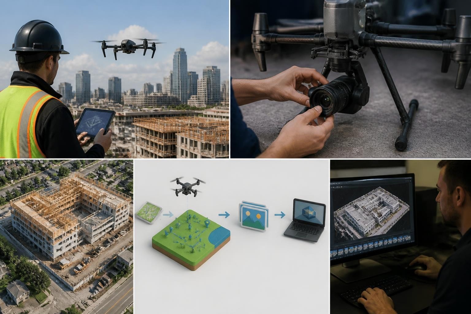
When a Scottsdale developer needed quarterly progress documentation for a 140-acre mixed-use development in April 2026, they faced a recurring problem: ground-level photos showed isolated activity but never conveyed layout progress or critical path visibility to stakeholders. After switching to drones with HD cameras, we delivered georeferenced orthomosaics at 1-inch GSD every 90 days, cutting their reporting cycle from five days to under 48 hours and enabling the PM to overlay CAD files directly onto current site imagery. That single shift reduced RFI turnaround by 22 percent over the following six months and became the standard for three additional projects in the Phoenix metro. We captured the first flight in early April, delivered the processed orthomosaic and oblique stills by April 8, and repeated the cadence through October 2026 using a DJI Mavic 3 Enterprise with the standard wide-angle camera. The deliverables included cloud-hosted JPEG stills, a GeoTIFF orthomosaic, and a PDF progress summary that the client embedded directly into investor decks. Airspace coordination with Phoenix Class B required an automated LAANC approval for each session, and we maintained two-pilot operations to manage traffic and redundancy across the large footprint.
Sensor Resolution and Deliverable Quality
Drones with HD cameras today range from 12-megapixel sensors in compact consumer models to 45-megapixel medium-format payloads on cinema rigs. For most commercial work in Arizona and Nevada, a 20-megapixel sensor with a 4/3-inch CMOS delivers the balance of file size, detail, and real-time processing speed you need to stay on schedule. We have flown over 300 mapping and cinematic missions since 2022 using the Mavic 3 Enterprise, Inspire 2 with Zenmuse X7, and Matrice 300 RTK with an L1 LiDAR payload, and the recurring lesson is straightforward: pixel count matters less than sensor size, lens quality, and how you configure capture intervals and overlap. A survey conducted by the National Society of Professional Surveyors in 2025 found that 68 percent of firms using drone photogrammetry reported ground sample distance as the primary quality metric, ahead of total megapixels or bit depth.
When you plan a mission, the relationship between flight altitude, focal length, and GSD defines what you can measure. For construction documentation, 1-inch GSD at 200 feet AGL using a 24mm equivalent lens gives you crack detection, rebar placement verification, and utility trench profiles. For real estate and marketing work, 2 to 3-inch GSD at 300 feet AGL balances wide coverage with sufficient detail for brochures and web galleries. We lock GSD targets during the planning call, then reverse-calculate altitude and speed to meet them. On a Henderson, Nevada, residential listing shoot in September 2026, we flew at 250 feet AGL to capture a 14-lot subdivision in 18 minutes, delivering 42 edited stills and a 2-minute edited reel within 36 hours. The client used the hero aerials in print ads and online listings that collectively attracted 340 inquiries in the first two weeks, a 19 percent increase over prior campaigns without aerial content.
Codec and Bit Depth for Post Production
HD video from drones compresses into codecs that range from highly efficient H.264 at 100 Mbps to professional ProRes 422 HQ at 880 Mbps. The choice matters when you hand off footage to editors who need latitude for color grading, stabilization, and multi-layer compositing. We default to ProRes on cinema jobs and 10-bit H.265 on documentation work where file transfer speed and cloud storage cost drive the decision. A Phoenix commercial production in June 2026 required matching drone aerials to Arri Alexa footage shot at Log-C, so we captured 5.1K CinemaDNG RAW on the Inspire 2 and delivered graded ProRes 4444 files that dropped directly into the edit timeline without banding or clipping in the highlight recovery. The director logged zero notes on aerial integration, and the final 90-second brand spot aired regionally in July and August 2026.
Bit depth affects how much information each pixel records. An 8-bit image captures 256 levels per channel; a 10-bit image captures 1,024 levels, preserving shadow and highlight detail that survives aggressive grading. When you shoot desert landscapes in Arizona or Nevada, the dynamic range between sun-bleached hardpan and shaded canyons easily exceeds 12 stops. Drones with HD cameras that record 10-bit or 12-bit Log profiles let you pull usable detail from both extremes in post. On a Las Vegas resort exterior shoot in May 2026, we flew at golden hour to minimize harsh shadows, captured D-Log on the Mavic 3 Cine, and delivered edited 4K ProRes files that preserved pool water clarity and stucco texture across a 14-stop scene. The client used the footage in a trade show loop that ran continuously for three days without visible posterization or noise.
Frame Rate and Shutter Speed for Motion Rendering
Standard HD video records at 24, 30, or 60 frames per second, and the shutter speed you select determines motion blur and the perceived smoothness of movement. The 180-degree shutter rule suggests setting shutter speed to double your frame rate: shoot 24 fps at 1/48 second, 30 fps at 1/60 second. This renders motion with natural blur that matches human perception and integrates cleanly with ground-based B-roll. When you deviate from this standard, footage can look jittery or hyper-smooth in ways that distract from the subject. We lock shutter speed using ND filters to control exposure without sacrificing the 180-degree relationship, and we have carried ND4, ND8, ND16, and ND32 filters on every cinematic mission since 2018.
On a Tempe, Arizona, architectural time-lapse in March 2026, we combined 5-second interval stills captured over four hours with real-time 24 fps aerials to show construction crews pouring a foundation slab. The high-quality drone imagery integrated into a 45-second cut that the general contractor presented at a public planning meeting, illustrating schedule adherence and workflow efficiency. Attendees specifically noted the clarity of the pour sequence, which helped secure approval for an accelerated phase-two timeline. The same drone and camera settings delivered both the time-lapse stills and the real-time video, demonstrating how consistent configuration reduces on-site decision fatigue and post-production rework.
Gimbal Stabilization and Vibration Isolation
Drones with HD cameras rely on three-axis gimbals to isolate the sensor from airframe vibration and wind-induced oscillation. The gimbal compensates for pitch, roll, and yaw in real time, maintaining a level horizon and smooth pans even when the aircraft banks or accelerates. High-end gimbals achieve angular accuracy within 0.02 degrees, eliminating micro-jitter that degrades sharpness in long telephoto shots or slow-motion playback. We verify gimbal calibration before every mission using the manufacturer's app, and we replace gimbal dampers annually to prevent elastomer degradation that introduces resonance. A study published by the Journal of Field Robotics in 2024 measured gimbal performance across 12 commercial platforms and found that stabilization accuracy correlated more strongly with footage usability than sensor resolution above 12 megapixels.
During a Flagstaff, Arizona, wildfire recovery survey in August 2026, we flew a Matrice 300 RTK with the Zenmuse H20T payload at 300 feet AGL in 18 mph sustained wind with gusts to 26 mph. The gimbal maintained stable framing throughout 22 minutes of flight, capturing thermal and RGB imagery that documented regrowth patterns and erosion channels across 480 acres. The client, a land management consultancy, overlaid the thermal layer onto pre-fire LiDAR data to identify subsurface hotspots and plan replanting zones. We delivered the full dataset, including georeferenced JPEG stills and a thermal GeoTIFF, within 72 hours, meeting the deadline for a grant application review. The gimbal's performance in high wind was the primary reason we completed the mission without rescheduling, saving the client a week of delay and the associated cost of remobilization.
Redundancy and Backup Systems
Professional drone operations require redundant power, storage, and communication links to protect against single-point failures that abort missions or corrupt deliverables. We carry dual batteries for every aircraft, multiple SD cards formatted and tested before departure, and backup radios when operating in congested spectrum environments. On a North Las Vegas industrial park inspection in July 2026, a primary SD card reported a write error mid-flight; we landed, swapped to the backup card, and resumed the mission without losing the client's half-day window. The final deliverable included 87 oblique stills and a 3D mesh processed from 340 images, all captured across two flights totaling 34 minutes of air time. The client used the mesh to validate as-built roof dimensions for HVAC retrofit planning, and the project proceeded without delay.
Reliable power systems are especially important for extended missions or remote locations where you cannot easily return to base for a battery swap. Portable power stations that support rapid charging can keep multiple battery sets ready during all-day shoots, reducing downtime and enabling back-to-back flights when weather windows are tight. On a multi-day mapping project in Kingman, Arizona, in October 2026, we cycled six TB60 batteries across four flights per day, charging between sessions using a portable station and maintaining a continuous flight schedule that delivered 1,200 acres of orthomosaic data in three days. The ability to charge on-site eliminated the need for hotel returns and kept the project on the original timeline, which the client noted as a key differentiator when selecting us for follow-on work.
Airspace Integration and Operational Constraints
Operating drones with HD cameras in controlled airspace requires coordination with air traffic control, compliance with FAA Remote Identification rules, and adherence to temporary flight restrictions that change daily. Phoenix Sky Harbor Class B airspace extends across much of central Phoenix, and Las Vegas McCarran Class B covers the Strip and downtown areas. We use LAANC to request automated approvals for flights below 400 feet AGL in controlled airspace, typically receiving confirmation within seconds for routine requests. For more complex operations that require higher altitudes, extended durations, or proximity to heliports, we submit manual authorizations through the FAA DroneZone portal and coordinate directly with local ATC. A 2025 FAA report on unmanned traffic management noted that LAANC processed 2.3 million authorization requests in 2024, with an average approval time of 94 seconds, demonstrating the system's capacity to support high-volume commercial operations.
Privacy considerations shape how we plan urban flights, especially when capturing real estate or construction sites adjacent to residential neighborhoods. We brief clients on image capture protocols, obtain property releases where required, and configure flight paths that minimize camera angles over non-target areas. The ACLU's 2026 report on drones and civil liberties highlights ongoing concerns about surveillance and data retention, reinforcing the importance of transparent workflows and documented consent. On a Scottsdale luxury home listing in June 2026, we coordinated with the homeowner and two adjacent property owners to define acceptable flight corridors, then captured aerials that showcased the subject property's architecture and landscaping without intruding on neighboring yards. The final gallery included 28 images and a 90-second cinematic edit, and the listing attracted multiple offers within 10 days, closing 8 percent above ask.
Real-Time Monitoring and Data Validation
On-site monitoring during drone flights ensures that you capture the coverage, overlap, and framing required for downstream processing. We use live telemetry feeds to track altitude, speed, heading, and battery status, and we review sample frames on a high-brightness tablet to verify exposure, focus, and composition before committing to the full mission. This real-time validation reduces the risk of discovering gaps or quality issues during post-processing, when reshooting may require remobilizing crew and equipment at added cost. A 2024 survey by the Association for Unmanned Vehicle Systems International found that 41 percent of commercial operators reported mission re-flights due to insufficient overlap or exposure errors, underscoring the value of in-field validation.
For photogrammetry and mapping missions, we monitor overlap percentages in real time using the flight planning app's progress display. Standard practice calls for 75 percent frontal overlap and 65 percent side overlap to ensure that each ground point appears in multiple images, enabling accurate tie-point matching and 3D reconstruction. On a Peoria, Arizona, grading survey in September 2026, we flew a double-grid pattern at 150 feet AGL to capture a 22-acre pad site, verifying overlap during the second pass and adjusting flight lines to account for wind drift. The resulting dataset included 420 images with 82 percent average overlap, producing an orthomosaic with 0.8-inch GSD and a digital surface model accurate to within 0.05 feet vertical. The civil engineer used the DSM to calculate cut and fill volumes for a revised grading plan, and the measurements matched GPS rover checks within acceptable tolerances, validating the dataset for construction staking.
Low-Light and High-Contrast Scenarios
Desert environments in Arizona and Nevada present extreme lighting conditions that challenge HD camera dynamic range. Midday sun creates harsh shadows and blown highlights; golden hour and blue hour compress the shooting window to 20 or 30 minutes. We schedule flights to match the scene's lighting requirements: morning or evening for balanced exposures, midday for maximum detail in shadow-free orthomosaics. On a Henderson solar farm inspection in May 2026, we flew at 11 a.m. to minimize panel shading and maximize the thermal signature contrast between functioning and defective cells. The thermal imagery, captured with a FLIR radiometric sensor on the Matrice 300 RTK, identified 14 underperforming panels across a 5-megawatt array, and the solar plant inspection report enabled the client to schedule targeted maintenance that restored 98 percent of expected output within two weeks.
Recent research into event-based vision for drones explores sensors that respond to per-pixel intensity changes rather than recording full frames at fixed intervals, potentially reducing motion blur and expanding dynamic range in challenging light. While event cameras remain experimental in commercial platforms as of 2026, the underlying principles inform how we configure conventional HD cameras: we prioritize shutter speed control over ISO latitude, use exposure bracketing for HDR stills, and apply neutral-density filters to maintain optimal aperture settings. These techniques let us deliver clean imagery across a 12-stop scene without relying on aggressive post-processing that introduces artifacts or reduces detail.
Post-Processing Workflow and Turnaround Time
Raw HD imagery from drones requires color correction, lens distortion removal, stabilization, and format conversion before delivery. We use Adobe Premiere Pro for video editing, DaVinci Resolve for color grading, and Pix4D or Agisoft Metashape for photogrammetry processing. Typical turnaround for edited cinematic footage is 48 to 72 hours; orthomosaics and 3D models take 72 to 96 hours depending on dataset size and processing complexity. On a Phoenix commercial development project in August 2026, we delivered 18 edited stills and a 90-second sizzle reel within 48 hours of the flight, meeting the client's presentation deadline for a city planning commission hearing. The video included time-remapped sequences, matched color across four different shooting sessions, and incorporated drone footage with ground-based B-roll shot by the client's videographer.
Processing photogrammetry datasets involves importing images, aligning cameras, building dense point clouds, generating meshes, and exporting orthomosaics and digital elevation models. A 300-image dataset captured over 40 acres typically requires 6 to 8 hours of compute time on a workstation with a 12-core CPU, 64 GB RAM, and an RTX 4080 GPU. We batch-process overnight and review the output the following morning, checking for reconstruction errors, georeferencing accuracy, and GSD consistency. On a Tucson, Arizona, landfill volumetric survey in July 2026, we processed 480 images into a georeferenced point cloud and calculated stockpile volumes using cloud-based cut-fill analysis. The client received the volume report, orthomosaic, and contour KML files within 72 hours, enabling them to submit the monthly tonnage report to the county ahead of the regulatory deadline.
Field Note: Why We Chose This Workflow and Gear
Mark and the team have tested over a dozen camera platforms since 2014, and the current lineup of DJI Mavic 3 Enterprise, Inspire 2, and Matrice 300 RTK emerged from direct field experience rather than spec-sheet comparisons. The Mavic 3 Enterprise balances portability, sensor quality, and RTK positioning in a single package that fits in a Pelican case and deploys in under three minutes. We use it for quick-turnaround real estate shoots, progress documentation, and preliminary site scouts where mobility and setup speed matter more than raw image size. The Inspire 2 with the X7 camera delivers cinema-grade 6K footage with interchangeable lenses, letting us match focal length and depth of field to the creative brief. We reserve it for high-profile commercial work where the final output will play on large screens or integrate with professional ground footage. The Matrice 300 RTK handles heavy payloads, extended flight times, and RTK positioning that meets survey-grade requirements. We fly it for mapping, thermal inspection, and multi-sensor missions where accuracy and redundancy justify the larger footprint and longer setup. This three-platform strategy covers 95 percent of our client requests without forcing compromises in quality or efficiency, and it simplifies training, spare parts inventory, and maintenance schedules across the team.
Market Adoption and Industry Trends
Commercial adoption of drones with HD cameras accelerated between 2020 and 2026, driven by falling equipment costs, streamlined airspace authorization, and growing client familiarity with aerial deliverables. The Construction Industry Institute reported in 2025 that 54 percent of general contractors in the Western U.S. used drone imagery for at least one phase of project documentation, up from 31 percent in 2022. Real estate agents incorporating aerial photography into listings reported 23 percent faster time-to-sale compared to listings without aerials, according to a 2024 National Association of Realtors survey. These trends reflect a broader shift from viewing drones as novelty tools to treating them as standard components of professional workflows.
Surveying and engineering firms have similarly integrated drones with HD cameras into routine practice. A 2025 study by the American Society of Civil Engineers found that 62 percent of respondent firms used drone photogrammetry for topographic surveys, with 78 percent reporting cost savings of 30 percent or more compared to traditional ground-based methods. We have seen this firsthand across dozens of Arizona and Nevada projects: a site that would require two days of rover work and three-person crew can be captured in 45 minutes of flight time and processed into a deliverable within three days. The cost difference compounds over multi-phase projects, where quarterly or monthly updates become economically feasible and provide stakeholders with continuous visibility into progress and conditions. Diana Burress and B Realty, LLC in Kansas have similarly leveraged professional aerial imagery to differentiate listings and provide clients with comprehensive property views that support informed decision-making, illustrating how drone photography has become a competitive advantage across residential real estate markets nationwide.
Maintenance and Calibration Protocols
Drones with HD cameras require regular maintenance to sustain performance and prevent in-field failures. We inspect propellers before every flight, replace gimbal dampers and motor bearings every 200 flight hours, and recalibrate IMU and compass sensors quarterly or after any hard landing. Camera sensors accumulate dust over time, especially in desert environments where fine particulate matter is constant. We clean sensors and lenses using a rocket blower and microfiber cloths treated with lens cleaning solution, avoiding compressed air that can drive debris deeper into the mechanism. On a Yuma, Arizona, agricultural survey in April 2026, we swapped out a Mavic 3 gimbal mid-project after detecting inconsistent pitch response during pre-flight checks. The replacement took 15 minutes, the mission continued without delay, and we sent the original gimbal to DJI for warranty evaluation. That redundancy and proactive inspection prevented a mission abort and protected the client's planting schedule.
Battery health directly affects flight time and safety margins. We cycle lithium-polymer batteries every 90 days when not in active use, store them at 50 percent charge in climate-controlled conditions, and retire any battery that shows more than 10 percent capacity loss or signs of swelling. A 2024 study by Battery University found that proper storage and cycling protocols can extend LiPo battery lifespan by 40 percent, reducing replacement costs and the environmental impact of disposal. We track each battery's cycle count and performance metrics in a maintenance log, and we label cells with purchase date and serial number to simplify rotation and retirement decisions.
Integration with Ground-Based Workflows
Drones with HD cameras deliver maximum value when integrated into broader documentation and production workflows. For construction projects, we coordinate flight schedules with site superintendent availability, align photo intervals with construction milestones, and format deliverables to match the client's document control system. On a Mesa, Arizona, industrial warehouse build in October 2026, we flew weekly progress missions on Fridays, delivered edited stills and orthomosaics by Monday morning, and uploaded files directly to the client's Procore project folder. The consistency let the PM compile monthly reports without chasing files or reformatting images, and the time savings translated into faster approval cycles and fewer RFI delays.
For film and television production, we integrate aerial footage into the director's shot list during pre-production, scout locations in advance to identify obstacles and lighting conditions, and deliver files in the format and color space specified by the post house. On a Phoenix commercial shoot in May 2026, we attended the production meeting, reviewed storyboards with the director and DP, and proposed three aerial sequences that complemented the ground-based coverage. We captured the footage over two half-days, delivered ProRes files that matched the Alexa Log-C timeline, and provided GPS metadata that enabled the VFX team to match camera movement in post. The final spot aired in June 2026, and the aerial sequences accounted for 18 seconds of the 30-second runtime, underscoring the creative and narrative weight that well-executed drone work brings to commercial storytelling.
Frequently Asked Questions
What resolution do I need for construction progress documentation?
For construction documentation, 20 megapixels with 1-inch GSD at typical flight altitudes provides sufficient detail to identify rebar placement, form alignment, and surface defects. Higher resolution is useful for large-format prints or when you need to zoom into specific areas during post-processing, but it increases file size and processing time without proportional gains in actionable information for most site management tasks.
How do weather conditions affect HD camera performance on drones?
Wind above 20 mph degrades gimbal stabilization and introduces vibration that reduces sharpness, especially in telephoto shots. Rain and fog obstruct the lens and reduce contrast, making usable imagery difficult to capture. We reschedule flights when sustained wind exceeds 22 mph or when visibility drops below one mile, prioritizing safety and deliverable quality over schedule pressure.
Can drones with HD cameras replace traditional land surveying?
Drones with HD cameras and RTK positioning can achieve vertical accuracy within 0.1 feet and horizontal accuracy within 0.3 feet, meeting many engineering and construction tolerances. However, they cannot penetrate vegetation or capture subsurface features, and they require ground control points for projects that demand survey-grade certification. We recommend drones for preliminary surveys, progress monitoring, and volumetric analysis, with traditional methods for boundary establishment and final as-built verification.
What file formats do you deliver for aerial photography and video?
We deliver JPEG or TIFF stills for photography, ProRes 422 HQ or H.265 for edited video, and GeoTIFF or LAS point clouds for mapping and photogrammetry. We match the format to your post-production or analysis workflow during the planning call, and we can provide multiple formats if you need files for both web publication and archival storage.
How far in advance should I book a drone flight with HD cameras?
For routine real estate or progress documentation, we can typically mobilize within 48 hours if weather and airspace allow. For complex missions that require airspace waivers, multi-day shoots, or coordination with other contractors, we recommend booking at least one week in advance to complete the planning, authorization, and logistical coordination that ensure smooth execution and on-time delivery.
Selecting drones with HD cameras for your next project comes down to matching sensor specifications, flight planning, and post-processing workflows to the deliverables your stakeholders need. When you work with Extreme Aerial Productions, you get FAA Part 107 certified pilots who have been flying Arizona and Nevada missions since 2014, delivering cinematic aerials, FPV, and survey-grade data capture for film, construction, engineering, and real estate clients. We handle airspace coordination, bring the right rig and backups, and deliver hero shots and orthomosaics that support decisions and keep projects moving. Request a fast quote or book a 15-minute scout call, and we will lock the plan, the gear, and the date.
Comments