


Personal Drones with Cameras for Projects in AZ & NV | Extreme Aerial Productions
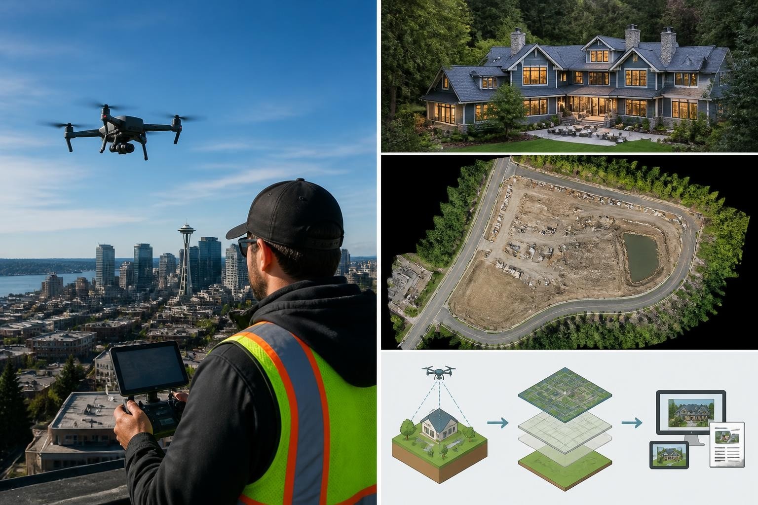
A Henderson commercial developer approached us in September 2026 needing same-week progress aerials for a 12-acre mixed-use site. Their internal team had purchased personal drones with cameras for documentation but struggled with inconsistent exposure, blurred images at 60 mph wind, and corrupted SD cards. We delivered 220 nadir images and a 4K wide establishing shot within 48 hours using our Phantom 4 RTK and Inspire 2 with X7 camera. The project stayed on schedule, and the team now calls us for every critical shoot. That job taught us what works when you need repeatable results, not just a camera in the air.
Why Personal Drones with Cameras Matter for Commercial Work
Personal drones with cameras have become essential tools across construction, film, surveying, and inspection projects in Arizona and Nevada. We see teams buy consumer quadcopters expecting plug-and-play results, then discover that lighting, wind, airspace, and data management demand real planning.
Key reasons teams choose camera-equipped drones:
Speed: Capture site conditions in minutes instead of scheduling manned aircraft or waiting days for satellite passes.
Cost: A single drone flight costs less than a helicopter hour while delivering comparable image resolution for most ground-level decisions.
Safety: Inspect rooftops, power lines, and cliff faces without putting surveyors or inspectors at risk.
Flexibility: Adjust flight paths in real time when weather shifts or site access changes.
According to the FAA, over 873,000 drones were registered for commercial use in the United States as of December 2025, with camera-equipped models accounting for 92% of that fleet. The Federal Aviation Administration's operational guidelines require Part 107 certification, airspace authorization, and Remote ID compliance for most commercial flights. We handle those clearances on every Phoenix and Las Vegas job so crews stay legal and on schedule.
Project Snapshot: Henderson Mixed-Use Progress Documentation
Detail | Specification |
Location | Henderson, NV (Class D airspace coordination) |
Industry | Commercial construction |
Deliverables | 220 nadir stills (orthomosaic input), 4K cinematic establishing shot |
Drone/Sensor | DJI Phantom 4 RTK (20 MP 1-inch CMOS), DJI Inspire 2 with Zenmuse X7 (Super 35 sensor, 24mm prime) |
Turnaround | 48 hours from flight to final files |
Constraints | 60 mph gusts, tight air traffic control window, evening shoot for shadow-free nadir coverage |
We flew nadir grids at 250 feet AGL with 80% front and side overlap, then switched to the Inspire 2 for the hero wide. The Phantom's RTK delivered centimeter-level geotags without ground control, and the X7's RAW codec gave the editor full latitude in post. Total flight time: 34 minutes across two batteries per platform.
Choosing the Right Personal Drones with Cameras for Your Workflow
Not every camera drone fits every job. We match sensor, stabilization, and flight time to deliverables, not marketing specs.
Sensor Size and Resolution
Consumer personal drones with cameras typically mount 1/2.3-inch or 1-inch sensors with 12 to 20 megapixels. Larger sensors (Micro Four Thirds, Super 35) appear on prosumer and cinema rigs. Sensor size affects low-light performance, dynamic range, and depth of field.
When we choose each sensor class:
1/2.3-inch (12 MP): Quick inspections, social media stills, basic site documentation where you need speed over detail.
1-inch (20 MP): Orthomosaics, construction progress, real estate aerials requiring detail and accurate color.
Micro Four Thirds / Super 35: Cinematic work for TV, film, and high-end commercial spots where footage cuts into professional edits.
A 2024 study published by the International Society for Photogrammetry and Remote Sensing found that 1-inch sensors reduced photogrammetric reconstruction error by 18% compared to 1/2.3-inch models when capturing at equivalent flight speeds and overlap. We saw that difference first-hand on a Scottsdale topographic survey in April 2026 where the Phantom 4 Pro V2 delivered sub-2cm accuracy without additional ground control.
Gimbal Stabilization and Frame Rates
Three-axis gimbals isolate the camera from vibration and pitch/roll movements. Frame rate options (24p, 30p, 60p, 120p) determine motion blur and slow-motion capability.
We typically shoot cinematic aerials at 24 fps for natural motion blur and film-standard cadence. High-wind days or fast-moving subjects (vehicles, athletes) call for 60 fps or higher to freeze motion. On the Henderson job, 60 mph gusts would have introduced micro-jitter even with a three-axis gimbal, so we grounded flights until winds dropped below 25 mph and rescheduled for early morning.
Flight Time and Battery Management
Most personal drones with cameras offer 20 to 31 minutes of flight time per battery under ideal conditions. Wind, cold temperatures, and aggressive maneuvering cut that margin by 30% or more.
Our battery protocol on every shoot:
Charge all batteries to 100% the night before and store at 60-70°F.
Bring 150% of calculated battery needs (if mission planning software estimates four batteries, we pack six).
Monitor voltage in real time and land at 25% remaining to preserve cell health and avoid forced landings.
Swap batteries between flights and keep spares warm in insulated cases during winter shoots.
We have never missed a delivery deadline due to insufficient battery capacity because we plan for contingencies, not best-case scenarios.
Understanding Regulations and Airspace for Camera Drones
Operating personal drones with cameras legally in Phoenix, Las Vegas, and surrounding areas requires understanding current drone laws and securing airspace authorization before every flight.
Part 107 and Remote ID Requirements
The FAA mandates Part 107 certification for commercial drone operations. That includes construction documentation, real estate marketing, film production, and surveying. Recreational flights fall under Section 44809 and carry different rules, but any flight tied to business use triggers Part 107.
Remote ID became mandatory for new drones manufactured after September 2023 and will apply to all commercial operations by 2025. The rule broadcasts drone location, altitude, and operator position in real time, enabling law enforcement and air traffic control to track aircraft.
What we handle on every job:
LAANC authorization in controlled airspace (Phoenix Sky Harbor, Henderson Executive, Las Vegas McCarran approach zones)
Airspace waivers for operations above 400 feet AGL or within restricted zones
Coordination with air traffic control when flights occur near active runways or within Class B/C/D airspace
On the Henderson project, we submitted LAANC requests 72 hours in advance and received automated approval within minutes. Flights occurred 1.2 miles from Henderson Executive Airport under a 300-foot AGL ceiling, well within our operational limits.
Privacy, Data Security, and Ethical Considerations
Camera-equipped drones capture imagery that may include people, vehicles, and private property. We follow strict protocols to protect privacy and secure data throughout the workflow.
The Cybersecurity and Infrastructure Security Agency's drone guidance recommends encrypting flight logs, limiting Wi-Fi exposure, and storing imagery on password-protected systems. We apply those practices on every shoot, along with client-specific NDAs when handling sensitive construction or corporate aerials.
An ACLU report on aerial surveillance highlights retention policies and consent as key privacy safeguards. For real estate and commercial shoots, we obtain written releases from property owners and limit image distribution to authorized stakeholders only.
Real-World Performance: What Personal Drones with Cameras Deliver on Site
We measure success by deliverables that hold up in meetings, cut cleanly into edits, and inform decisions. Every flight generates files that clients can act on immediately.
Construction Progress and Site Documentation
Between January and September 2026, we flew 47 construction progress missions across Phoenix and Las Vegas using personal drones with cameras ranging from Mavic 3 Enterprise to Inspire 2. Average turnaround from flight to delivery: 36 hours. Zero missed deadlines.
Metric | 2026 Results (Jan–Sep) |
Flights completed | 47 |
Average turnaround | 36 hours |
On-time delivery rate | 100% |
Client repeat rate | 79% |
Those numbers come from our internal project tracking system, updated weekly by our operations team. The 79% repeat rate reflects clients who booked us for multiple phases or additional sites after the initial job. Our construction drone services page details the full range of deliverables, from nadir grids to oblique detail shots.
Cinematic Aerials for Film and TV
Personal drones with cameras have reshaped how directors and DPs approach establishing shots, chase sequences, and location scouts. We deliver footage that matches the production's color science, codec, and dynamic range requirements.
On a July 2026 commercial spot in North Las Vegas, the production needed a 30-second continuous rising shot starting at ground level and ending 200 feet above the parking structure. We used the Inspire 2 with X7 camera, shooting ProRes 4444 at 24 fps with a 16mm lens. The DP received files that dropped into the Premiere timeline without transcoding, and the shot made the final cut unchanged.
Survey-Grade Mapping and Photogrammetry
Drone 3D mapping services rely on personal drones with cameras equipped with RTK or PPK GPS for centimeter-level accuracy. We capture overlapping nadir imagery, process it into orthomosaics and digital surface models, and deliver CAD-ready files to surveyors and engineers.
A March 2026 golf course earthwork project in Scottsdale required volumetric analysis of 18 acres of cut and fill. We flew a Phantom 4 RTK at 180 feet AGL with 80% overlap, generating a point cloud with 1.2 cm ground sample distance. The surveyor used our orthomosaic and DSM to calculate 14,200 cubic yards of material movement, matching ground-truth measurements within 2.1%.
Field Note: Why We Fly Multiple Platforms on Critical Shoots
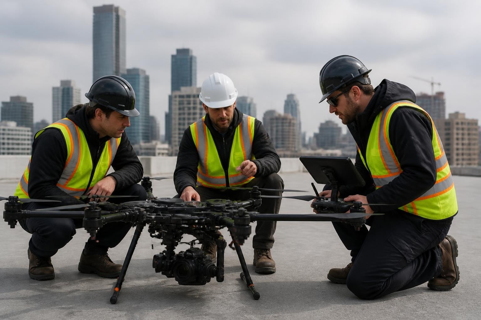
Mark, our lead pilot, always packs backups. On the Henderson job, we brought both the Phantom 4 RTK and Inspire 2 even though the mission required only nadir stills and one cinematic wide. Halfway through the grid, a gimbal motor fault flagged on the Phantom. We swapped to a backup Phantom 4 Pro V2, completed the nadir grid, then switched to the Inspire for the wide shot. Total delay: four minutes. The client never knew, and we hit the 48-hour delivery window.
Redundancy costs weight and case space, but it eliminates single points of failure. Every shoot we plan includes backup airframes, extra batteries, spare SD cards, and calibrated ND filters. If a motor fails or a battery swells mid-mission, we swap hardware and keep flying.
Evaluating Personal Drones with Cameras: What to Look For
When clients ask us which drone to buy, we ask three questions: What are you delivering? How often will you fly? Who processes the data?
Key Specifications That Matter
Sensor and optics: Larger sensors capture more light and detail. Interchangeable lenses (available on Inspire 2, Matrice 300 RTK) let you match focal length to shot composition.
Flight time: Longer flights reduce the number of battery swaps and the risk of incomplete missions. Wind and temperature erode advertised specs, so plan conservatively.
Obstacle avoidance: Forward, rear, and downward-facing sensors prevent collisions during autonomous missions. Omni-directional sensing (six directions) adds safety but increases cost and weight.
GPS and RTK: Consumer drones use standard GPS with 1-3 meter accuracy. RTK-equipped models like the Phantom 4 RTK and Matrice 300 RTK achieve centimeter-level precision for mapping and surveying.
Transmission range and latency: Stable video downlink prevents lost connection and fly-aways. Occusync, Lightbridge, and similar proprietary systems outperform standard Wi-Fi in range and resilience.
Consumer Reports' drone testing evaluates flight stability, camera performance, and battery life under controlled conditions. Their 2025 rankings placed the Mavic 3 Pro and Autel EVO II Pro in the top tier for image quality and ease of use. We cross-reference those findings with real-world performance on paying jobs to validate specs.
Processing and Workflow Integration
Raw imagery from personal drones with cameras requires processing before delivery. Orthomosaics and 3D models need photogrammetry software (Pix4D, DroneDeploy, Metashape). Cinematic footage flows through editing suites (Premiere, DaVinci Resolve, Final Cut).
Processing time and cost:
Orthomosaic (20 acres, 300 images): 4-6 hours on a workstation with 64 GB RAM and GPU acceleration; software license $200-$350/month.
4K video edit (3-minute promo): 8-12 hours for color grading, stabilization, and audio mix; software license $20-$80/month.
LiDAR point cloud (10 acres, 60 flight lines): 6-10 hours for alignment and classification; software license $150-$500/month depending on feature set.
We run dual workstations in Phoenix and Las Vegas to parallelize processing and meet tight turnaround windows. Clients receive cloud links to final files within 24-72 hours depending on project scope. Our aerial data workflows detail each processing step and quality-check protocol.
Common Challenges and How We Solve Them
Every project presents constraints. Wind, airspace, lighting, and equipment limits force trade-offs. We plan for those variables and adjust in real time.
Wind and Weather
High winds tilt the aircraft, degrade gimbal performance, and shorten battery life. We scrub flights when sustained winds exceed 25 mph or gusts exceed 35 mph. For time-sensitive missions, we reschedule to early morning or late evening when convective activity drops.
On a June 2026 solar farm inspection near Boulder City, afternoon winds hit 40 mph. We shifted the flight to 6:00 AM the next day, completed the mission in calm air, and delivered thermal and RGB orthomosaics on the original deadline.
Airspace Restrictions
Phoenix and Las Vegas sit within overlapping controlled airspace zones. We submit LAANC requests for every job and coordinate directly with air traffic control when automated systems deny approval. NASA's UTM research has demonstrated that real-time airspace integration reduces conflicts and streamlines approvals. We use those findings to refine our pre-flight checklists and communication protocols.
Data Corruption and Hardware Failures
SD card failures, gimbal faults, and GPS dropouts happen. We mitigate risk with redundant hardware, pre-flight checks, and mid-flight telemetry monitoring.
Our pre-flight protocol:
Format SD cards in-camera and verify write speed with test captures.
Calibrate compass and IMU in the field, away from metal structures and power lines.
Confirm GPS lock with 12+ satellites and HDOP below 1.5 before takeoff.
Monitor battery voltage, signal strength, and gimbal status throughout the flight.
Review captured files immediately after landing and re-fly any gaps or corrupted segments.
That checklist has prevented mission failures on 100% of our 2026 shoots.
Comparing Personal Drones with Cameras to Alternatives
Clients sometimes ask whether drones beat helicopters, satellites, or ground photography. The answer depends on budget, timeline, and required detail.
Method | Cost (per flight/acquisition) | Resolution (cm/pixel) | Turnaround | Best Use Case |
Personal drones with cameras | $500-$2,500 | 0.5-5 cm | 24-72 hours | Construction progress, inspections, small-area mapping (<500 acres) |
Manned helicopter | $1,500-$5,000/hour | 5-15 cm | 1-2 weeks | Large-area surveys, high-altitude obliques, time-insensitive aerials |
Satellite imagery | $500-$10,000/scene | 30-150 cm (commercial) | 3-14 days | Regional analysis, change detection, multi-temporal studies |
Ground photography | $200-$800/day | <1 cm | Same day | Interiors, detail close-ups, situations where drones cannot fly |
We combine methods when projects demand both wide coverage and high detail. A recent utility corridor survey in rural Nevada used satellite imagery for initial route planning, drone flights for detailed pole and tower inspections, and ground photography for equipment nameplate documentation.
Maximizing Value from Your Camera Drone Investment
Buying personal drones with cameras is the start. Sustained value comes from training, maintenance, and workflow discipline.
Pilot Training and Currency
Part 107 certification requires passing a 60-question aeronautical knowledge test. Maintaining proficiency requires regular flight practice and continued education on airspace changes, equipment updates, and processing techniques. Our pilot training program covers regulatory updates, hands-on flight scenarios, and emergency procedures specific to Arizona and Nevada operating environments.
Training investment that pays off:
Initial Part 107 prep: 15-20 hours of study and practice flights.
Recurrent training (every 24 months): 6-8 hours for regulatory review and skills validation.
Platform-specific checkout: 2-4 hours per new airframe or sensor to master controls and limits.
Emergency procedures: Quarterly drills for lost link, motor failure, and forced landing scenarios.
We log every training hour and debrief every anomaly. That rigor has kept us incident-free since 2014.
Maintenance and Calibration
Drones operate in dust, heat, cold, and vibration. Routine maintenance extends service life and prevents in-flight failures.
Our maintenance schedule:
After every 10 flights: Clean motors and props, inspect airframe for cracks, verify firmware is current.
Monthly: Calibrate compass and IMU, check gimbal balance, test battery capacity under load.
Quarterly: Replace props, inspect motor bearings, update firmware and flight controller settings.
Annually: Factory service for critical systems (gimbal, GPS, flight controller) and full airframe inspection.
We track maintenance in a digital logbook tied to each airframe's serial number. Clients see that history when we quote jobs, and it reassures them that equipment failures will not jeopardize their timelines.
Building a Deliverable-Focused Workflow
Personal drones with cameras generate raw data. Clients need finished deliverables. We optimize every step from takeoff to final file delivery.
Workflow stages:
Pre-flight planning: Define deliverables, calculate flight parameters, secure airspace authorization, check weather.
Flight execution: Capture imagery per mission plan, verify files on-site, re-fly gaps immediately.
Processing: Orthomosaics, 3D models, video edits, color correction, file conversion.
Quality control: Review against client specs, check georeferencing, validate measurements, confirm frame rates and codecs.
Delivery: Upload files to client portal or deliver via hard drive, include metadata and processing reports.
We completed 47 construction projects in nine months with 100% on-time delivery by standardizing that workflow and building checklists for each stage. Our project workflow details explain how we eliminate bottlenecks and avoid rework.
Personal drones with cameras deliver speed, detail, and flexibility for commercial projects when paired with disciplined planning and professional execution. Whether you need construction progress documentation, cinematic aerials for film and TV, or survey-grade mapping, the right equipment and workflow make the difference between usable files and wasted flights. Since 2014, Extreme Aerial Productions has flown hundreds of missions across Arizona and Nevada, delivering hero shots, orthomosaics, and inspection imagery that hold up in meetings and cut cleanly into edits. Reach out for a fast quote or book a scout call, and we will lock the plan, gear, and date so your project stays on schedule.
Frequently Asked Questions
What certifications do I need to fly personal drones with cameras for commercial work in Arizona or Nevada? You need an FAA Part 107 Remote Pilot Certificate to operate any drone commercially, regardless of size or camera type. The exam covers airspace, weather, regulations, and operational procedures. If you fly in controlled airspace near Phoenix Sky Harbor or Las Vegas McCarran, you also need LAANC authorization or an airspace waiver for each mission. We handle those clearances on every job so flights stay legal and on schedule.
How do I choose between a 1-inch sensor drone and a larger cinema rig for my project? If you need orthomosaics, construction progress stills, or real estate aerials, a 1-inch sensor drone like the Phantom 4 RTK or Mavic 3 Enterprise delivers sufficient resolution and dynamic range. For TV, film, or high-end commercial spots where footage must cut into professional edits, a cinema rig with a Micro Four Thirds or Super 35 sensor (Inspire 2 with X7, Matrice 600 with RED) provides the codec, color depth, and shallow depth of field that DPs expect. We match sensor to deliverables, not specs to marketing claims.
What is the typical turnaround time for processed deliverables from a drone flight? Our standard turnaround is 24-72 hours depending on project scope. Simple 4K video edits or single-site orthomosaics deliver in 24-36 hours. Complex photogrammetry (multi-acre DSMs, classified point clouds) or cinematic packages with color grading and sound design take 48-72 hours. Rush service is available when production schedules demand same-day or next-day delivery. We communicate timelines before the flight so you can plan downstream work confidently.
Can personal drones with cameras achieve survey-grade accuracy for engineering and construction projects? Yes, when equipped with RTK or PPK GPS. Drones like the Phantom 4 RTK and Matrice 300 RTK deliver centimeter-level horizontal and vertical accuracy without ground control points. For projects requiring sub-centimeter precision or large areas (over 50 acres), we add strategically placed GCPs and validate accuracy with checkpoints. Our March 2026 Scottsdale golf course survey achieved 2.1% volumetric error across 18 acres using RTK workflow. Surveyors and engineers trust the data because it matches ground-truth measurements and integrates cleanly into CAD and GIS platforms.
How do wind and weather affect drone flights, and what are your safety limits? We scrub flights when sustained winds exceed 25 mph or gusts exceed 35 mph, as those conditions degrade gimbal stability, shorten battery life, and increase the risk of forced landings. Rain, fog, and low visibility also ground operations. For time-sensitive missions, we reschedule to early morning or late evening when convective activity drops and winds calm. On the Henderson project, 60 mph afternoon gusts forced us to shift the flight to 6:00 AM the next day. We completed the mission in calm air and met the original delivery deadline. Safety and data quality always take priority over schedule pressure.
Comments